We have planned for a couple of years to go to Alaska this year, and now we are on our way. Check back for occasional updates.
Sunday, May 29th
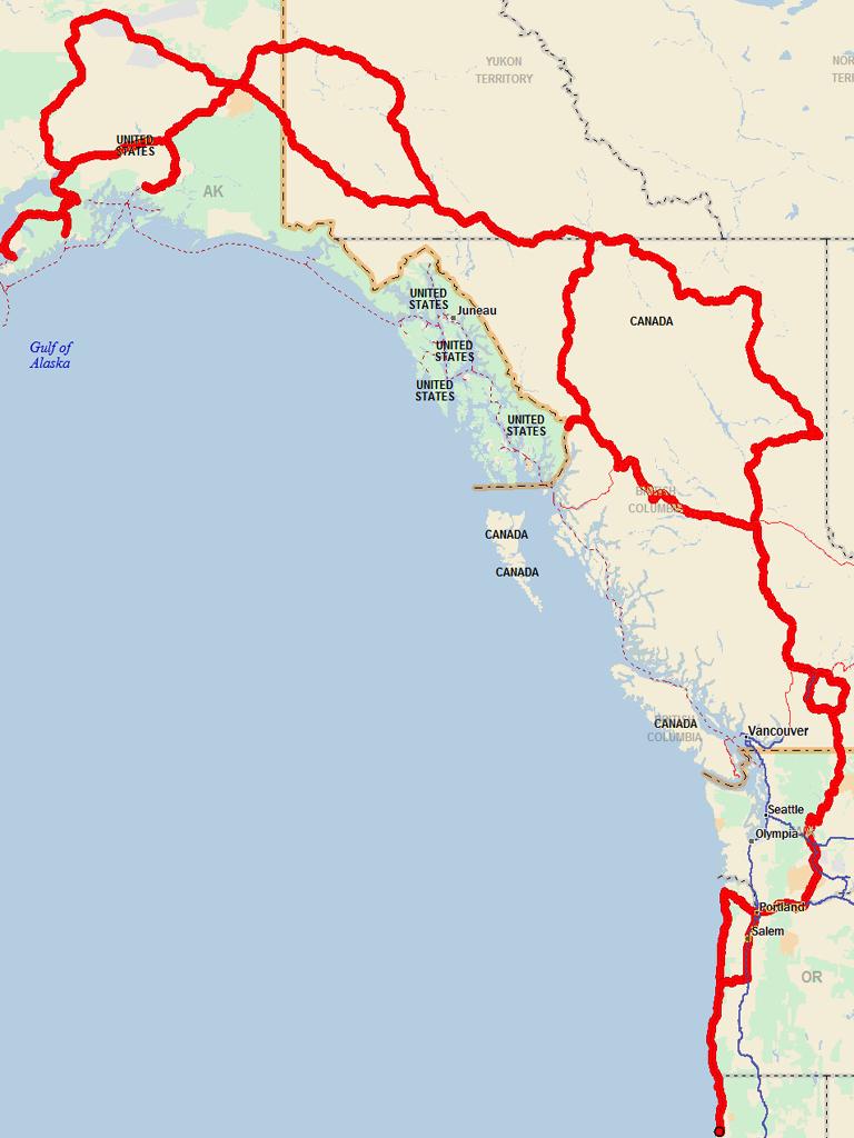
We traveled slowly up the Oregon coast, partly because this is Nikki's first trip so we wanted her to adjust slowly, and partly because we hadn't been anywhere in more than 6 months so we wanted to shake-out any issues with the bus.
We stopped two nights each in Brookings and Coos Bay, one night in Newport, and 3 in Seaside, then over to Portland for the long Memorial Day weekend.
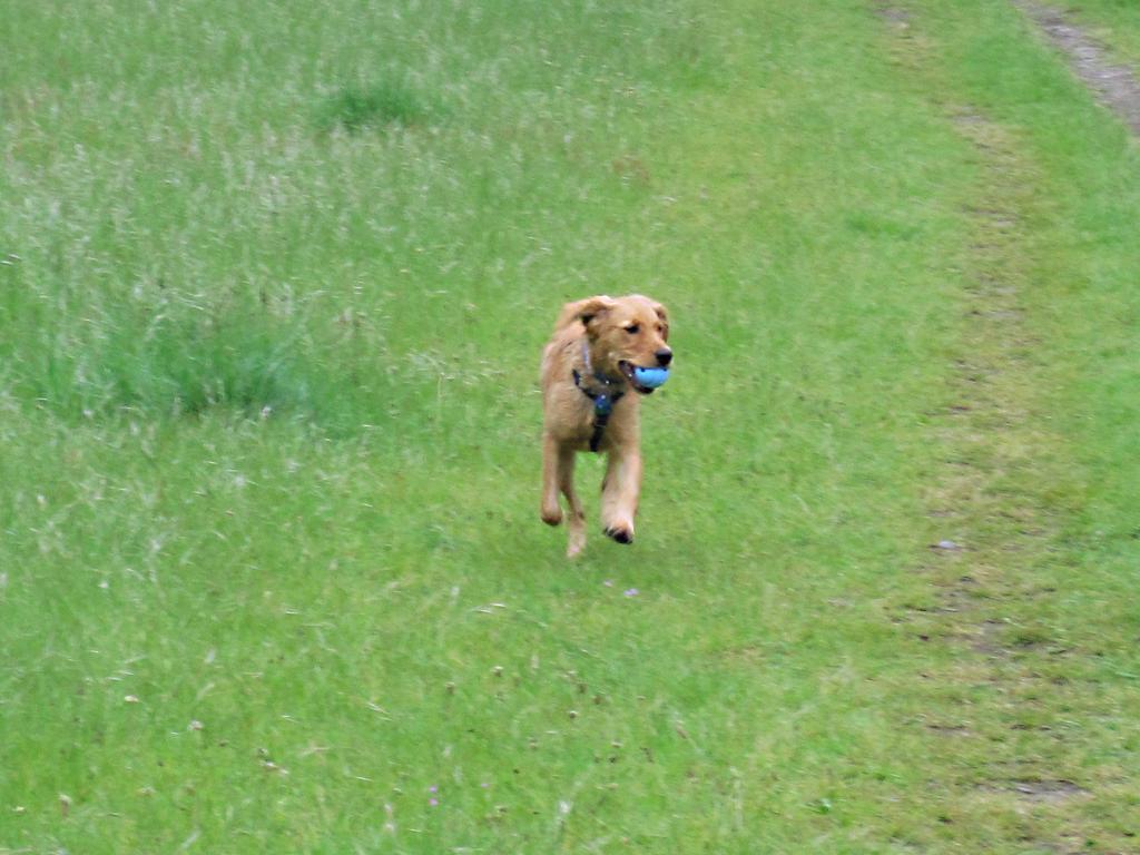
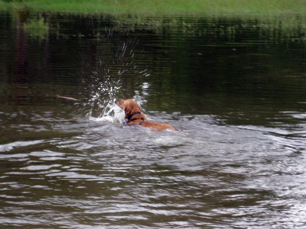
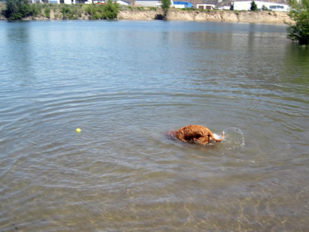
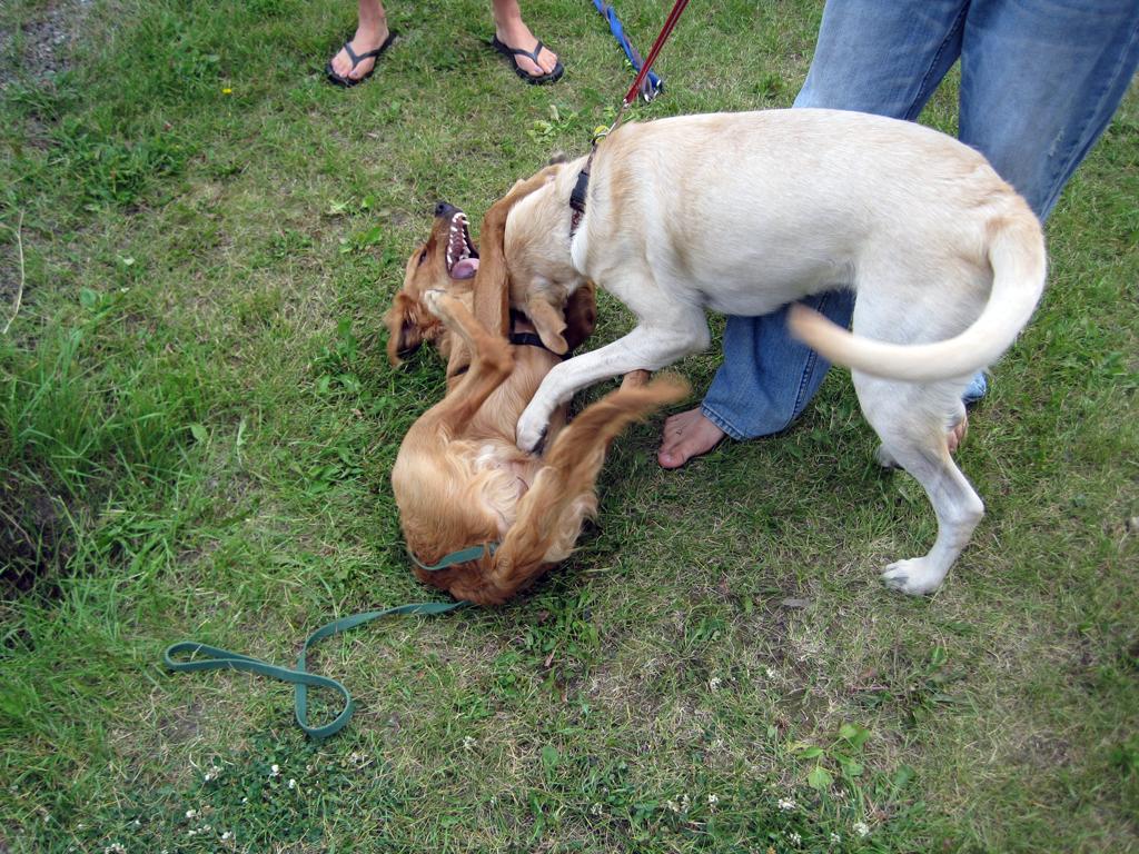
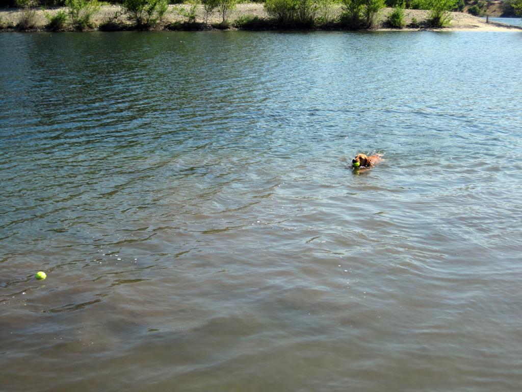
Nikki does best if she gets lots of hard exercise, so we hit dog parks in Portland and Vancouver every day we were there. Nikki had her first water experience today, swimming well but also just wanting to play with the water droplets that she was kicking up.
Sandy River Delta off-leash area
Sandy River Delta off-leash area
Tuesday, May 31st
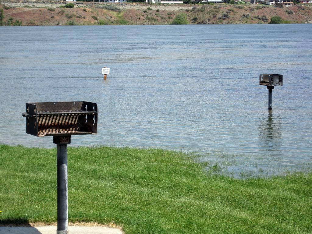
After an overnight in Toppenish we are at Wenatchee River County Park for two nights before heading into Canada.
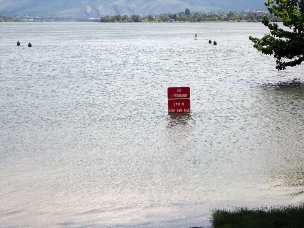
The water that Nikki is splashing in, above, is not normal - the Columbia is flooding low-lying areas. That is more obvious in the pictures below, taken in Confluence State Park in Wenatchee.
Flooding at Confluence State Park, Wenatchee
Flooding at Confluence State Park, Wenatchee
Saturday, June 4th
We spent the day around Kamloops, BC. Weather has finally turned nice, and now we are complaining of the heat!
Nikki hasn't learned that balls float, so she spent quite a bit of time searching the bottom of the Thompson River before spotting where it was.
Citizens mounted patrol in Kamloops
Diving for tennis ball in the Thompson River
Sunday, June 5th
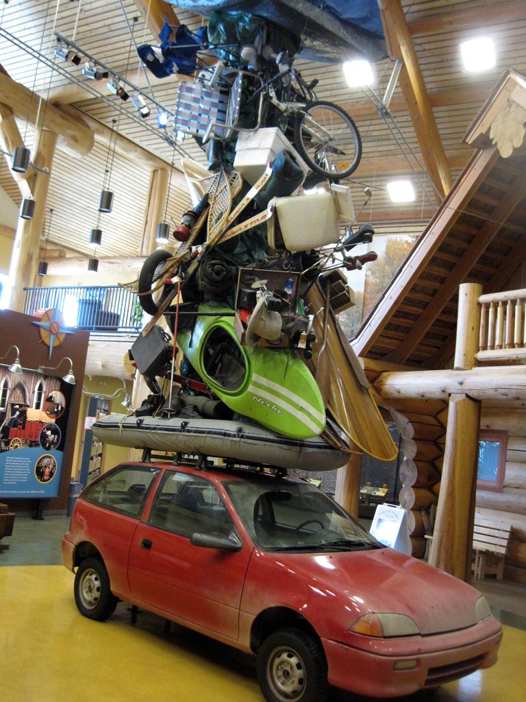
We overnighted in the parking lot of the visitor's center in Williams Lake. They had this well-provisioned car inside the building.
Monday, June 6th
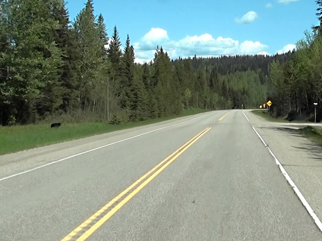
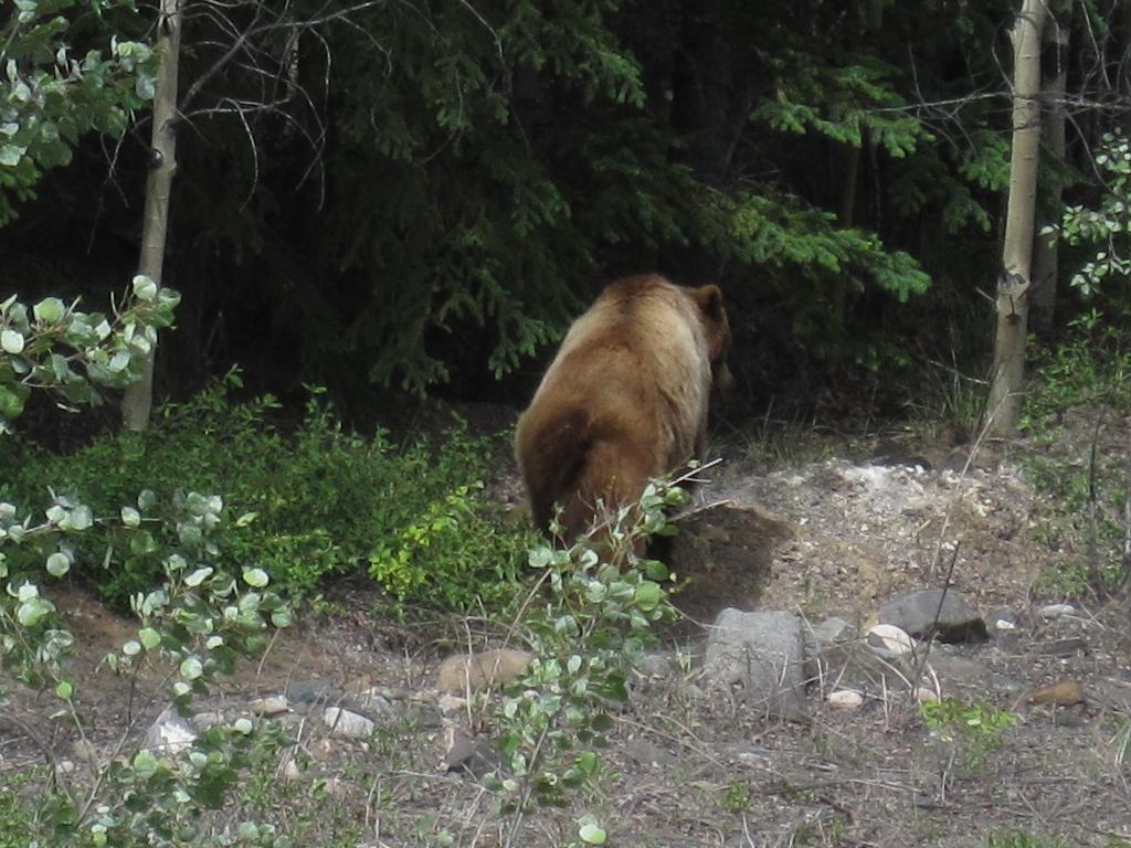
Today we drove up the Cariboo Highway to Prince George. We saw our fist bald eagle and first bear so far today. Running a videocam continuously as a dash-cam we caught a shot of the bear, but not the eagle which was too much overhead. Video stills aren't the best pictures, but we never would have gotten this one otherwise. Visible off to the left in the picture.
Bear by the Cariboo Highway
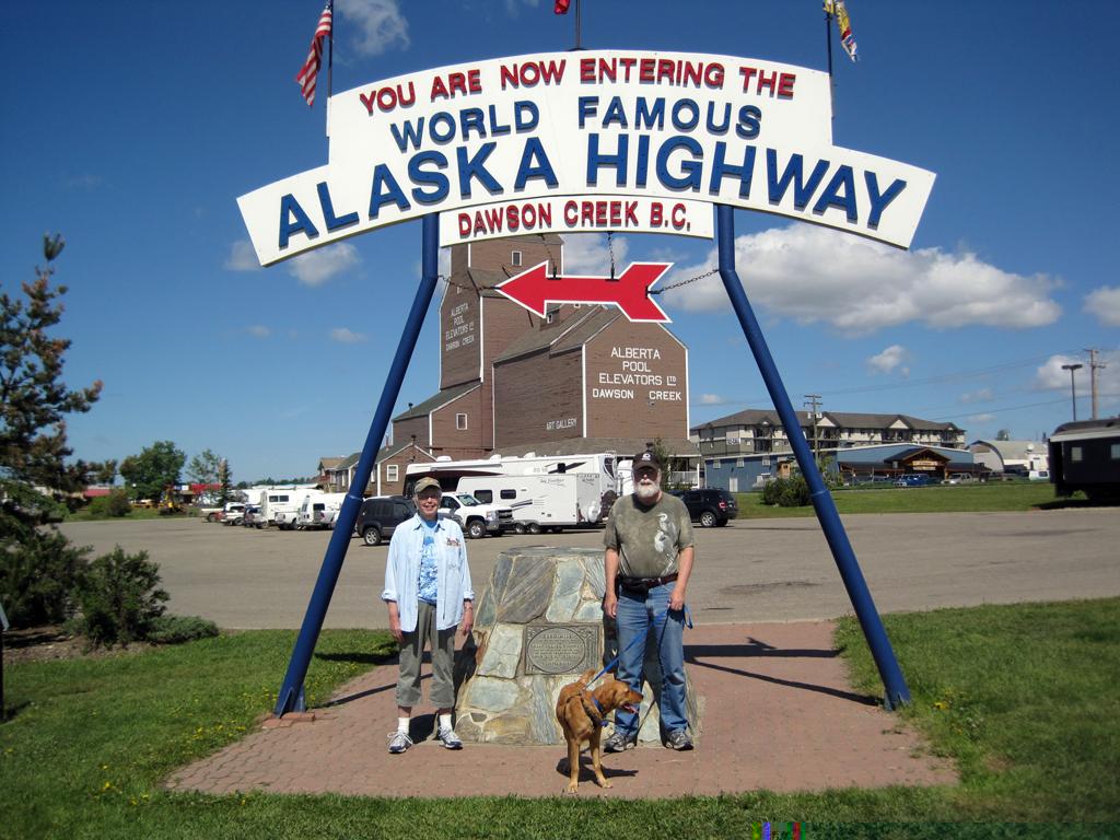
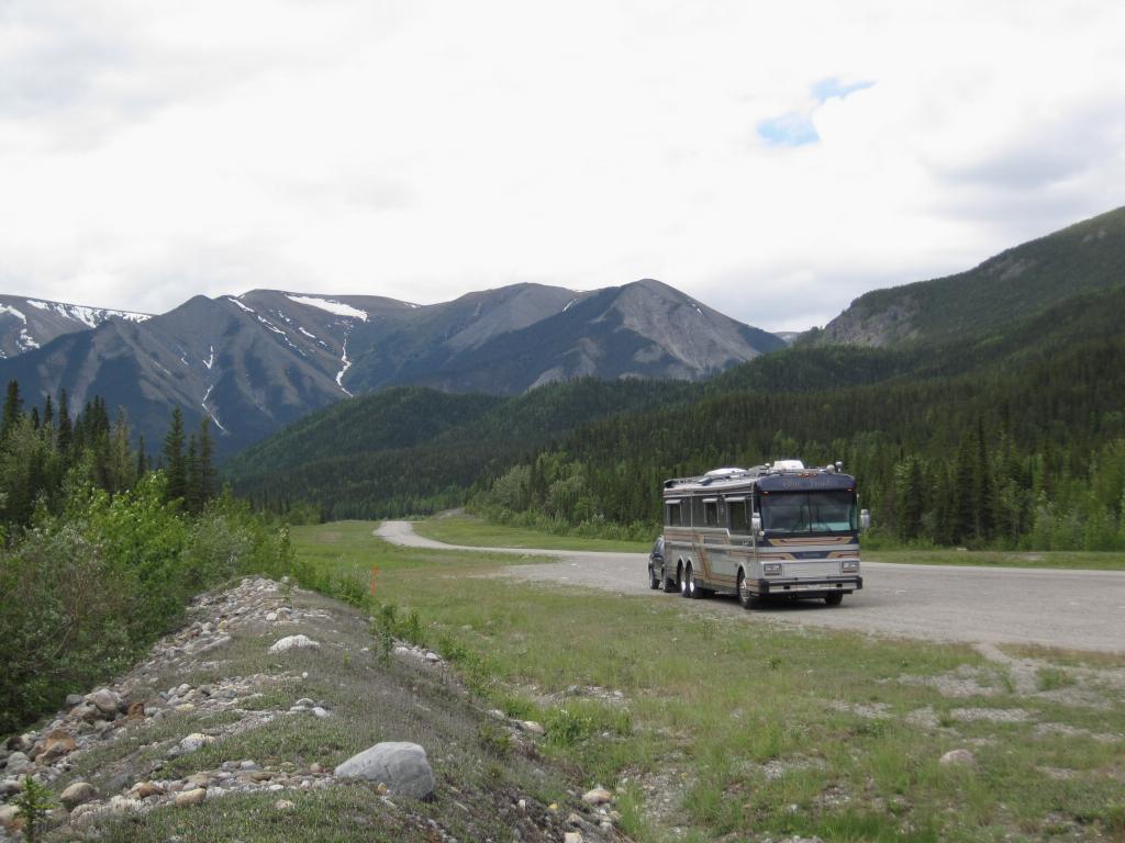
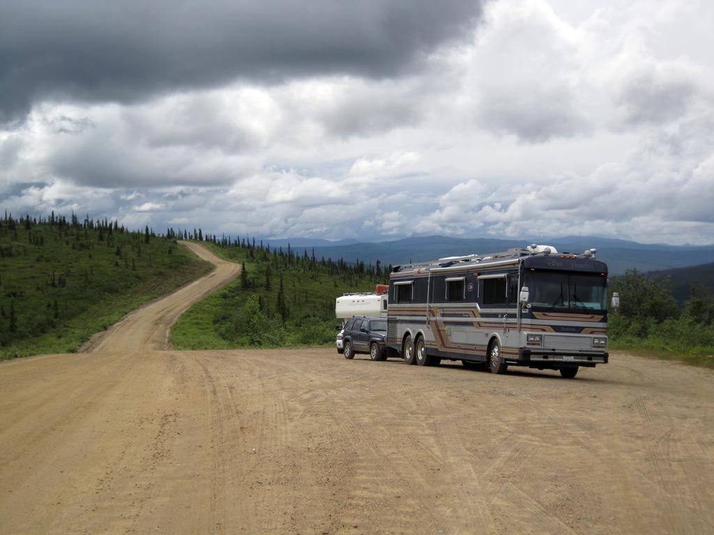
Wednesday, June 8th Yesterday we drove from Prince George to Dawson Creek, where we are staying three nights. Here is the obligatory tourist shot at the start of the Alaska (AlCan) highway, on which we will depart Friday.
A bear ambled across the road in front of us yesterday, but it was raining so of course the dash-cam was focused on the raindrops and the bear was just a fuzzy shape! So much for the great dash-cam idea! Still have hopes of capturing wildlife shots that we wouldn't otherwise be quick enough to capture.
Today we did a long day from Dawson Creek through Fort Nelson to Toad River
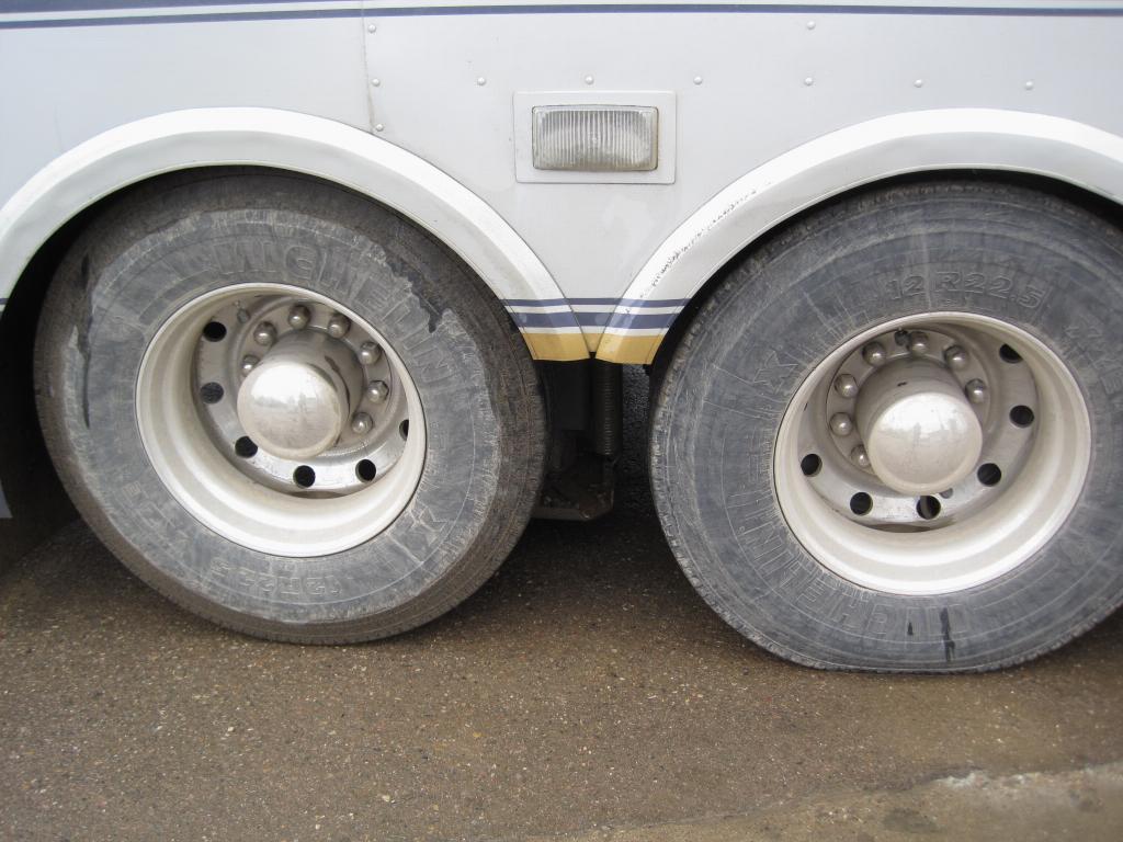
This is what my nice shiny wheels looked like at a fuel stop in Fort Nelson.
Fort Nelson
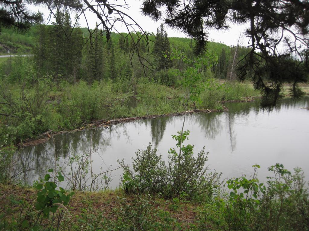
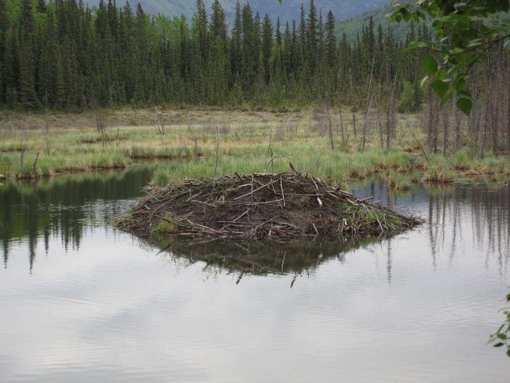
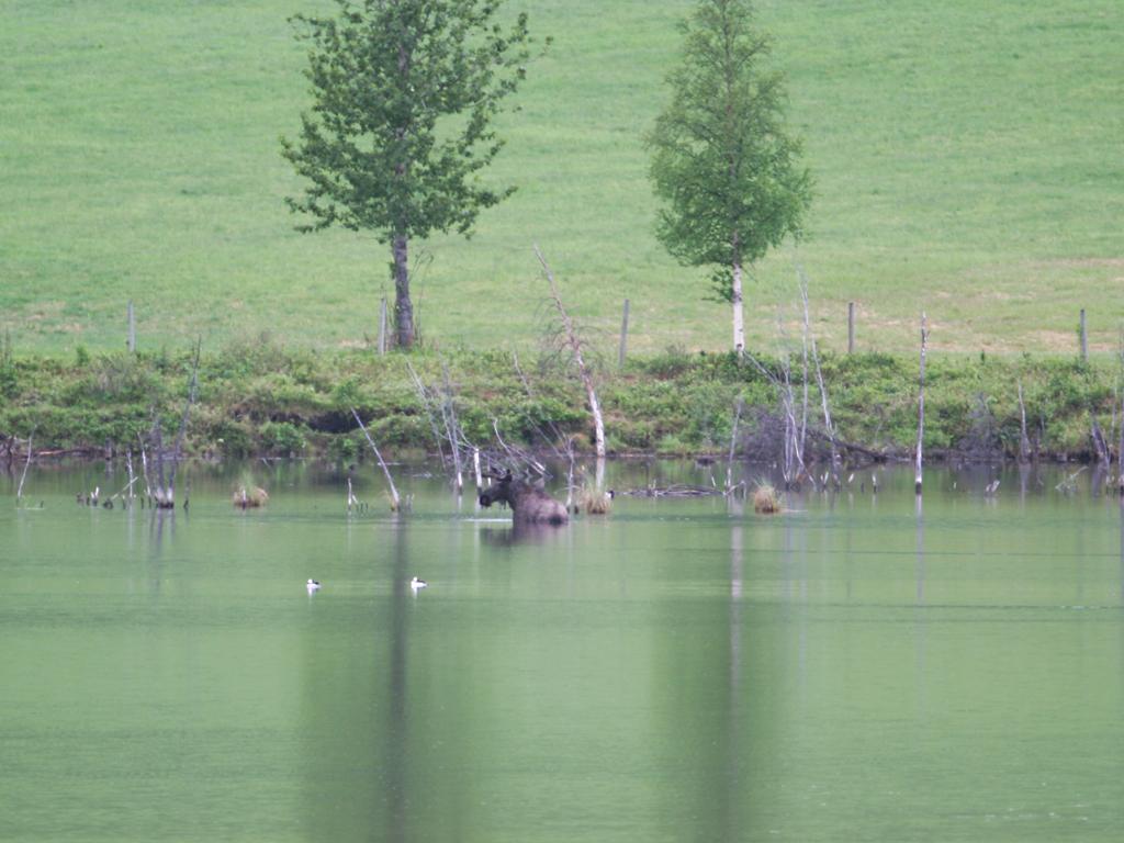
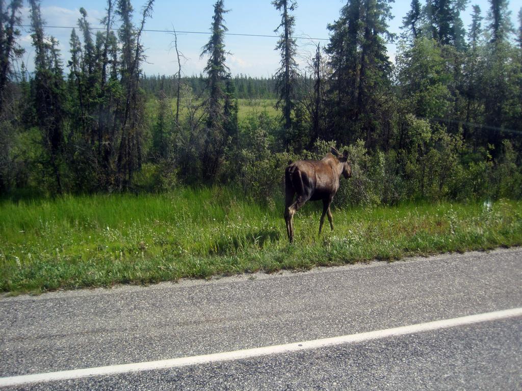
At Toad River, BC we observed a very large beaver dam, the associated lodge, and a couple of the dam builders.
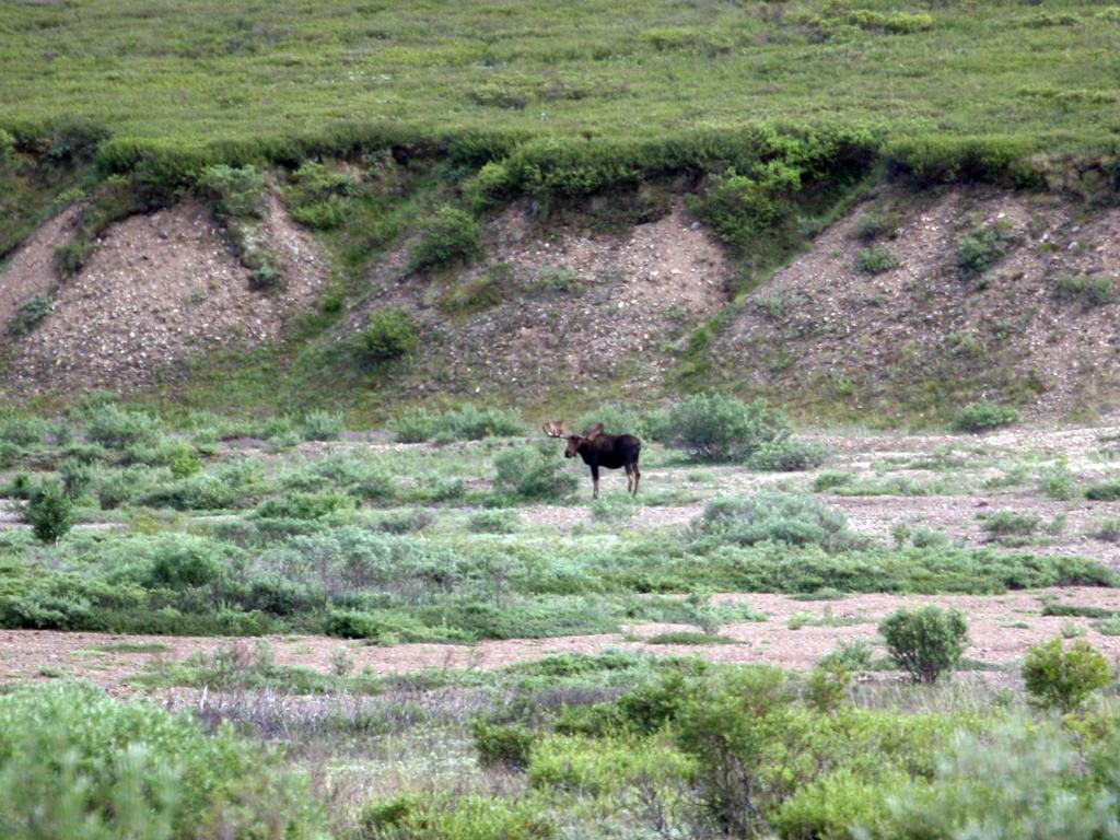
Also at Toad River there was a Bull Moose in the water on the far edge of a lake - extreme telephoto shot.
Beaver Dam at Toad River, British Columbia
Beaver Lodge at Toad River, British Columbia
Bull Moose at Toad River, British Columbia
Beaver at Toad River, British Columbia
Young bear on the Alaska Highway
When we passed this young bear it was standing on its hind legs off the side of the road, but too far off to be caught by the dashcam.
After traveling a safe distance we stopped, and captured a few shots with a telephoto lens as the bear crossed the highway.
Saturday, June 11th
Today we traveled from Toad River to Watson Lake, home of the famous Forest of Sign Posts. It would take many dozens of photos to properly show these - suffice to say that the rows of posts cover a great deal of ground.
Parked by the Trout River on the Alaska Highway
The forest of signposts at Watson Lake
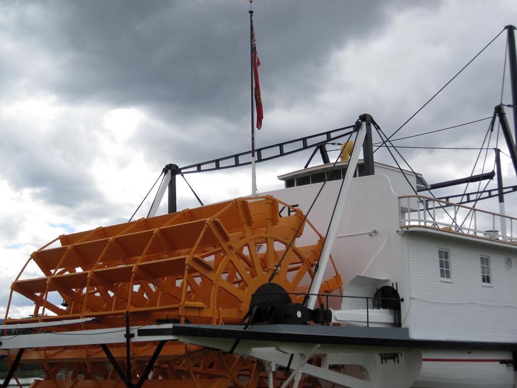
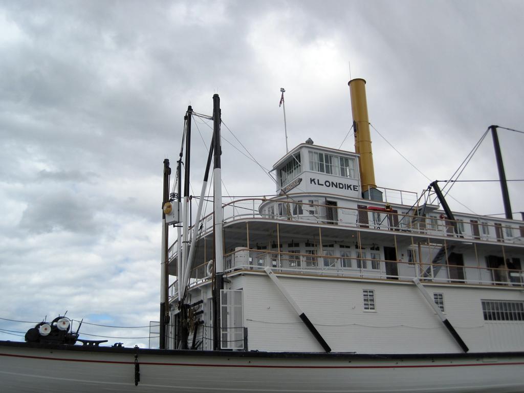
The SS Klondike is a restored Yukon Riverboat maintained by Parks Canada in Whitehorse.
SS Klondike in Whitehorse
SS Klondike in Whitehorse
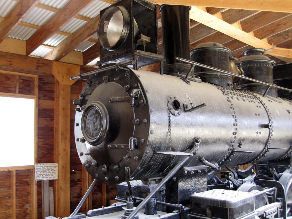
"Engine No. 51 is a Wood-fired Brooks Mogul 2-6-0 built in 1881 in New York. The locomotive was shipped north in 1898 to help build the White Pass and Yukon Railway.
Rebuilt in 1900 and re-named Engine No. 51, she operated as a passenger and freight train between Skagway and Whitehorse from 1901 to 1919. By the 1920s, sternwheeler excursions to the Southern Lakes region of the Yukon were very popular. Part of the trip involved transferring passengers from Tagish Lake overland by rail to Atlin Lake. The Taku Tramway was nicknamed the World's Shortest Railway. Engine No. 51 ran this line until 1931 when she returned to service on the WP&YR line and operated as a freight engine until 1941.
During World War II and the construction of the Alaska Highway, the White Pass engines were required to haul heavy loads of supplies and equipment. Engine No. 51 was replaced by a new and more powerful diesel locomotive."
WP&YR Engine No. 51
Grizzly bear south of Carmacks
This grizzly bear walked across the highway in front of several cars, and I got this shot as it ambled into the woods. I got a couple of other pictures that weren't as good, but made the distinctive shoulder hump and facial profile clear that it was a grizzly rather than a brown black bear.
Wednesday, June 15th
We travelled north along the Yukon towards Dawson City, overnighting in Carmacks.
Going for a walk on the boardwalk in Carmacks
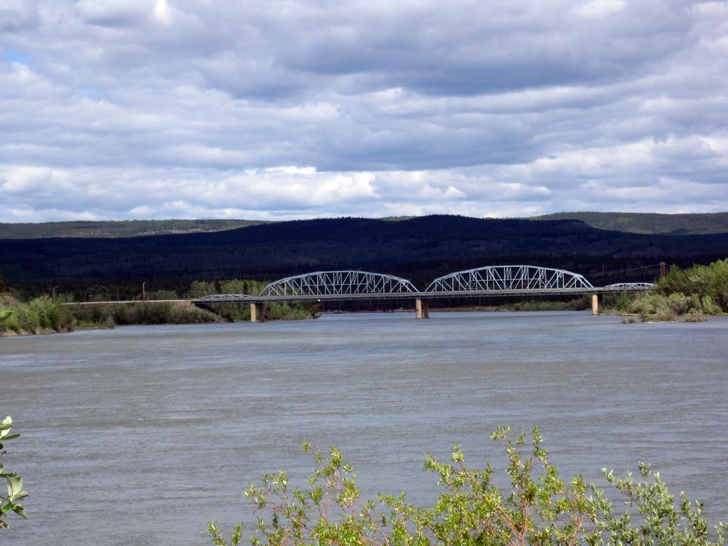
Yukon River bridge at Carmacks
Thursday, June 16th
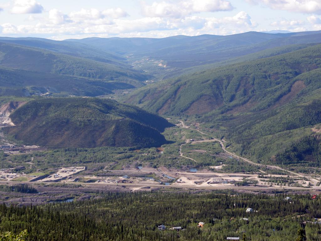
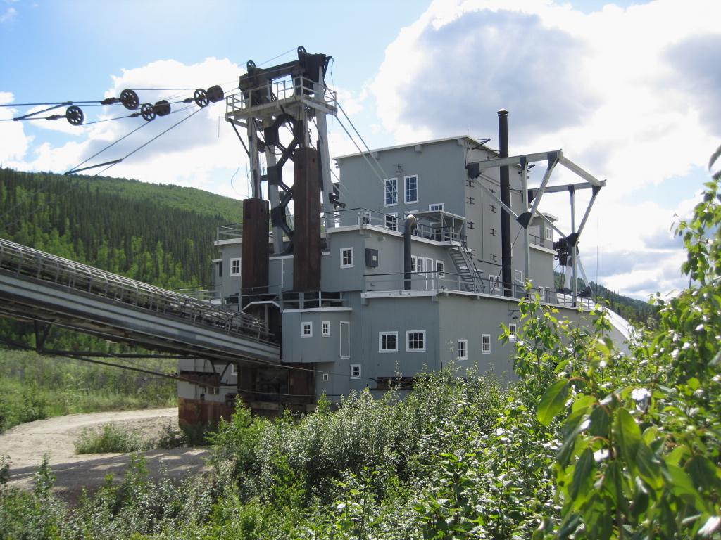
The primary gold rush in the Klondike area began with a strike on Bonanza creek in 1897. The picture below left is a view up Bonanza creek to the south, taken from the Midnight Dome hill north of Dawson. The Klondike river itself runs left-to-right, hidden but near the bottom of the picture. Dredging was commonly done in the area in the early 20th century, and the Canadian Parks Service has restored this dredge on Bonanza Creek. Dredge tailings are all over the Klondike river bottom in the left photo.
View of Bonanza Creek
Dredge number 4 on Bonanza Creek
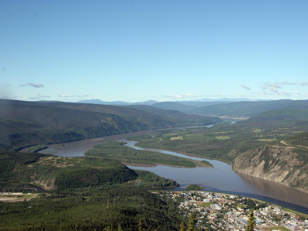
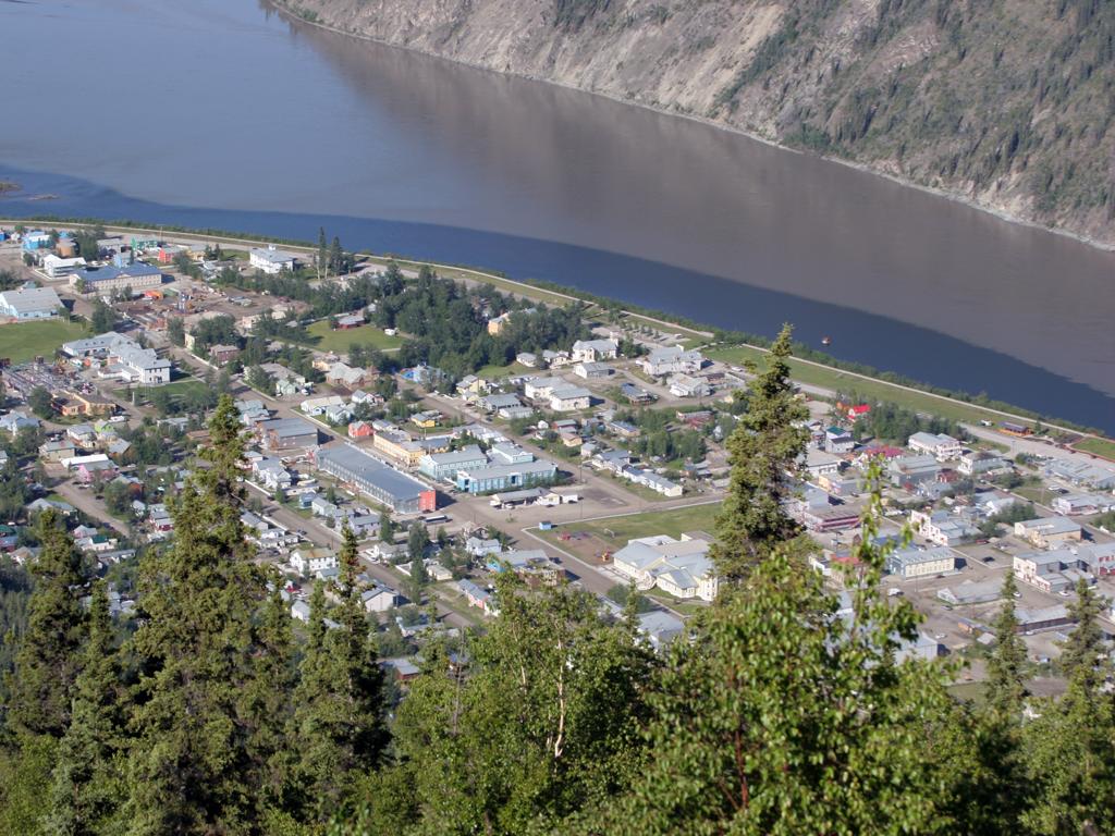
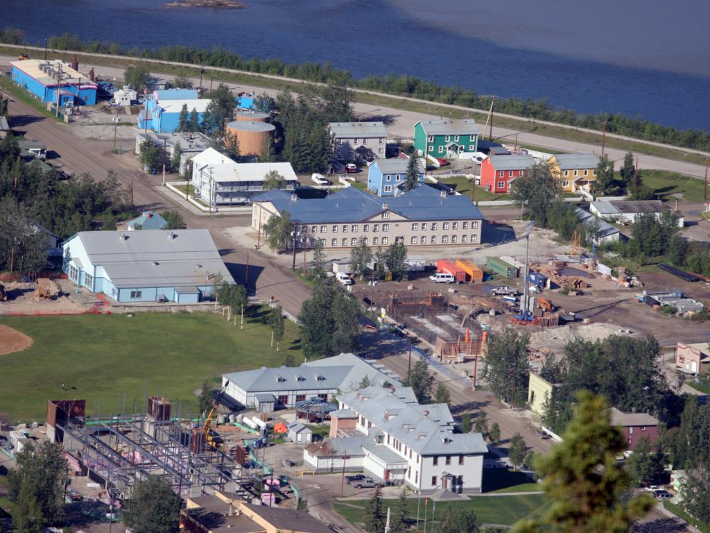
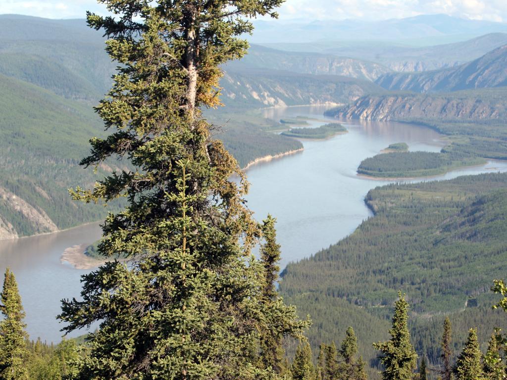
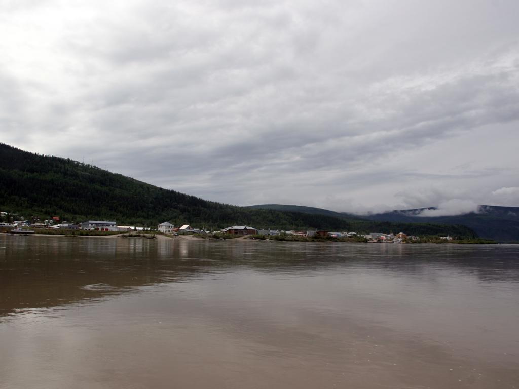
Dawson, or Dawson City, is at the confluence of the Klondike and the Yukon. In the pictures below, the dark water is from the Klondike before it mingles with the browner water of the Yukon.
There are many active mines around Dawson and the town survives on mining and tourism. Only the main highway (Front Street) is paved, while all other streets are packed dirt, usually with raised boardwalk sidewalks.
The Yukon River upstream from Dawson
Dawson City from the Midnight Dome
Some new construction in Dawson City
The Yukon downstream (north) from Dawson
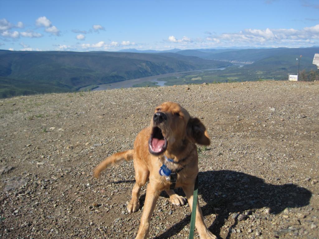
Nikki says she doesn't want to go the way we want her to go.
Nikki at the Midnight Dome
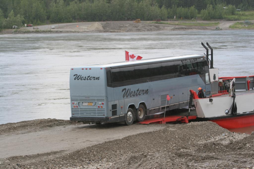
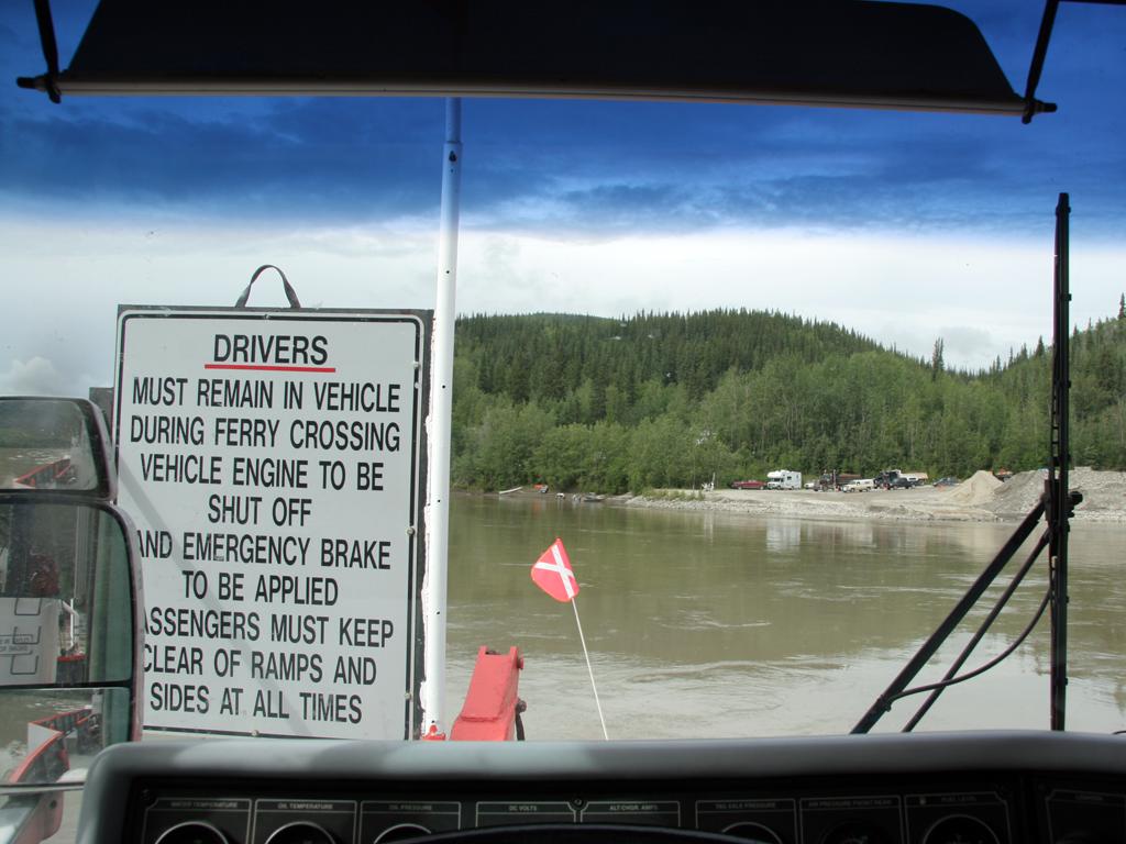
The northbound highway ends at Dawson City, with a free ferry crossing to the other side where the Top of the World highway begins headed for Alaska.
There are warnings about possible difficulties for low-clearance vehicles getting on and off the ferry, so we watched a few different vehicle types make the journey.
The current is strong, so when the ferry shoves off it is swept several hundred yards downstream in an arc until it can make headway on the other side to move into the landing there.
A fuel tanker loads on the George Black ferry at Dawson City.
A tour bus loads on another run
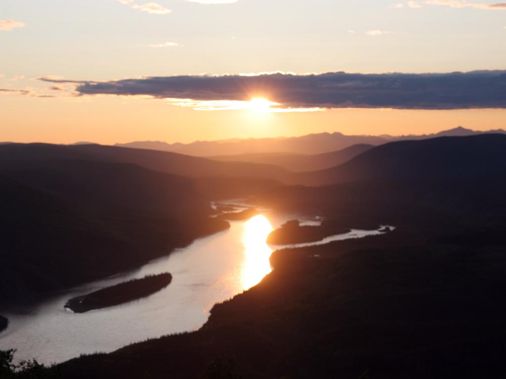
I joined many others on top of the Midnight Dome for this picture taken exactly at midnight. There was a cooperative cloud, since otherwise the sun would have washed out the photo too much.
Midnight sun from the Midnight Dome at Dawson City
Tuesday, June 21st
We Crossed the Yukon River on the ferry, which is a short interesting trip. Getting off the ferry we failed to clear as the front tires dropped onto the sand, and they had to use boards to get the front high enough to get us off. Fortunately no harm done.
Approaching the west shore of the Yukon River
Dawson City seen from the middle of the river on the ferry
Dashcam video of loading onto the ferry:
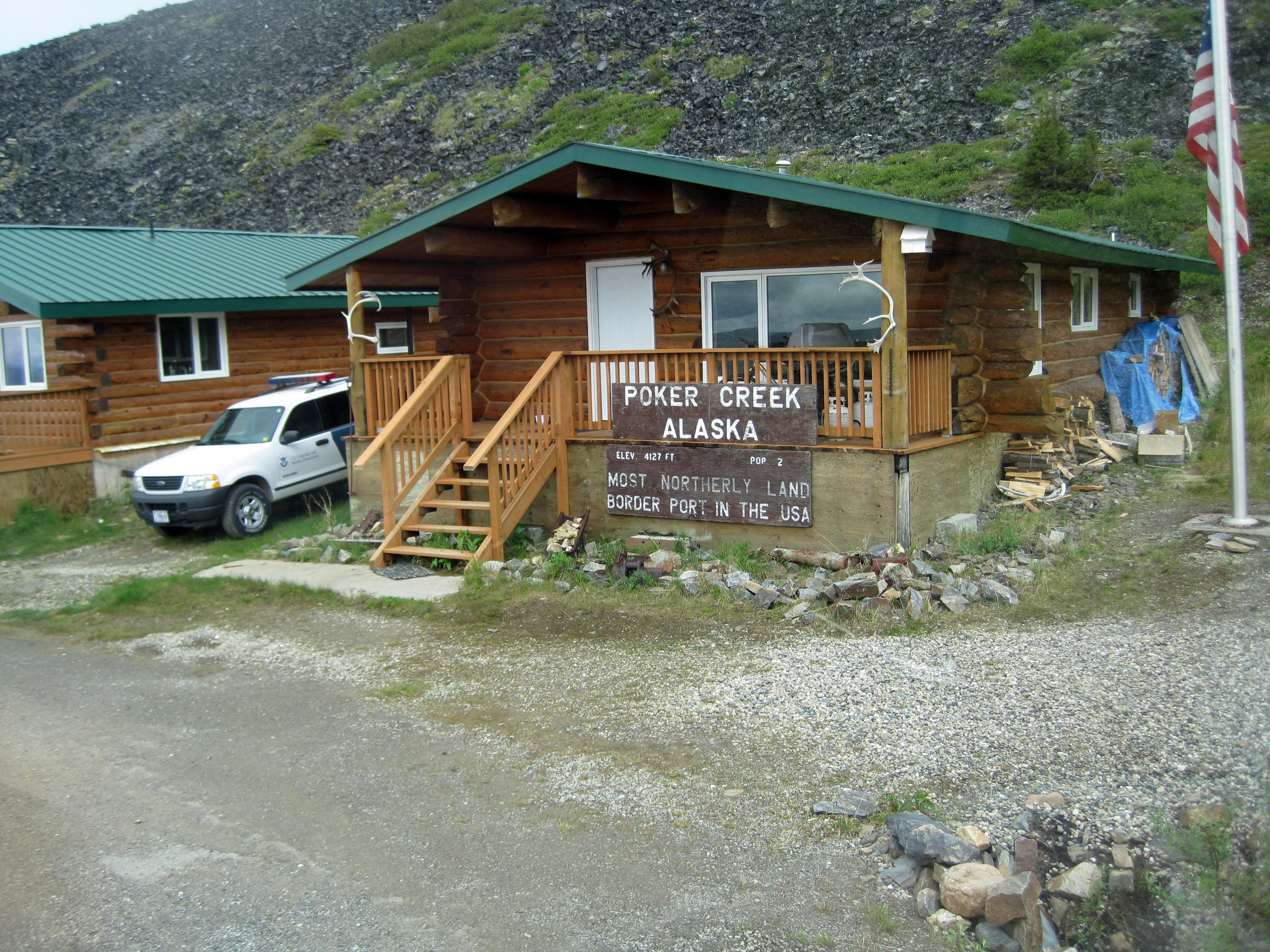
We crossed the border at Poker Creek, the northernmost land border crossing point in the US. From that point the road became dirt for the next 45+ miles to the town of Chicken, where we overnighted before moving on to Tok and then to Valdez.
US-Canada border crossing at Poker Creek, AK
On the road to Chicken, AK
Friday, June 24th
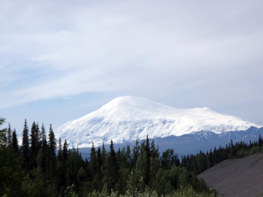
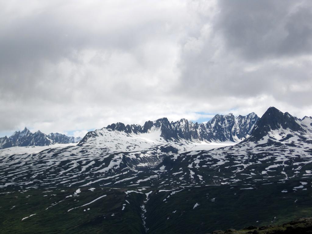
As we grew closer to Valdez the scenery got more spectacular. Very high mountains in the Wrangell-St Elias National Park, and sharp peaks in the mountains along the coast covered with glaciers.
16,000 ft Mt Sanford in Wrangell-St Elias National Park
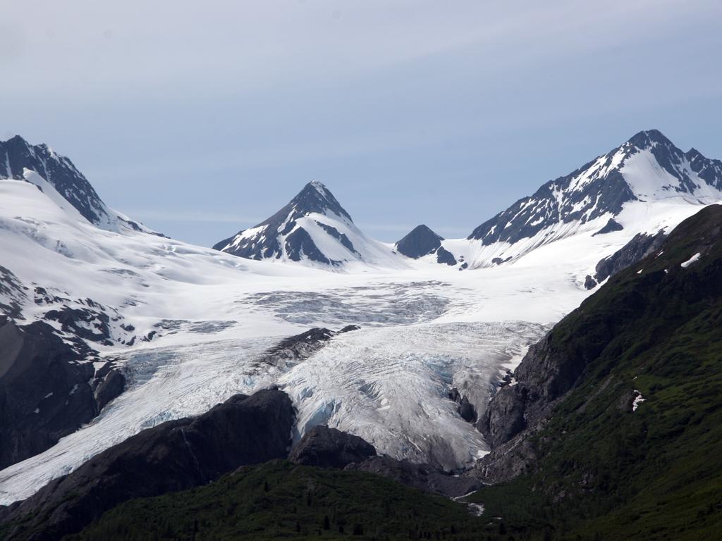
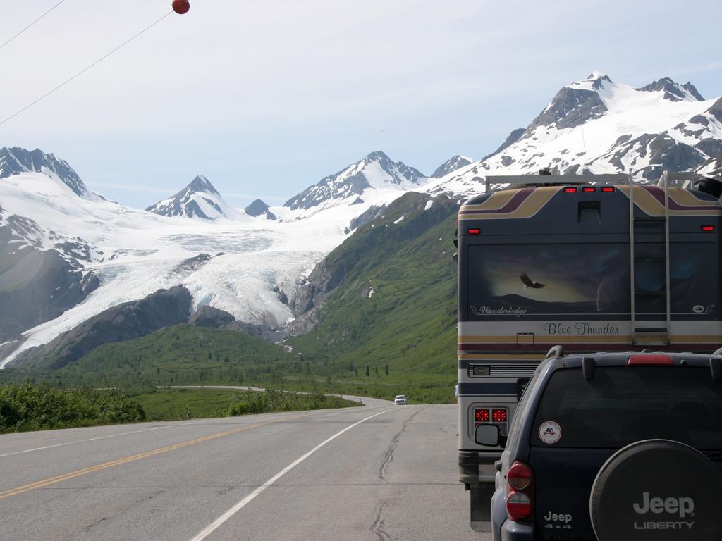
Worthington Glacier above Thompson Pass near Valdez
Worthington Glacier from the highway
Hikers high on Worthington Glacier
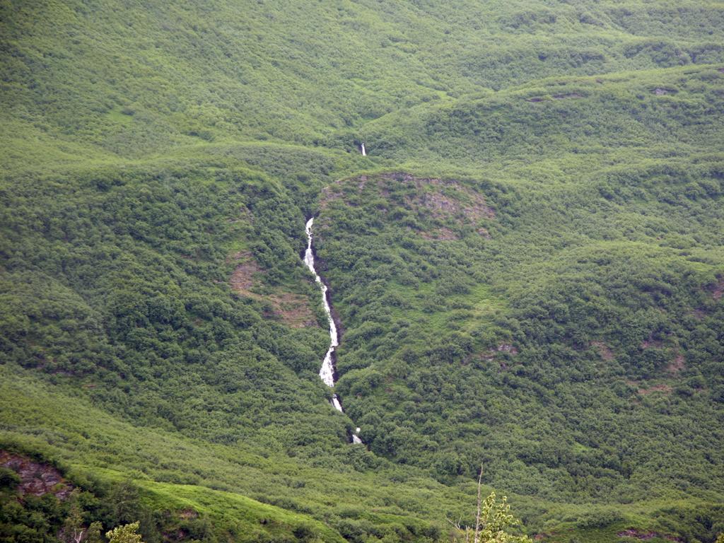
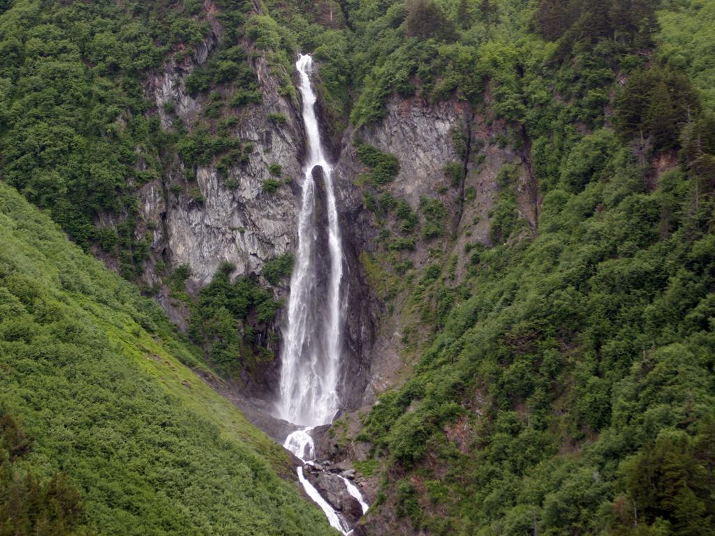
The 30 miles down from Thompson Pass into Valdez includes a lot of spectacular scenery. Lots of snowy mountains and waterfalls.
Looking South from Thompson Pass
Bridal Veil Falls in Keystone Canyon on the Lowe River
Horsetail falls, also in Keystone Canyon on the Lowe River
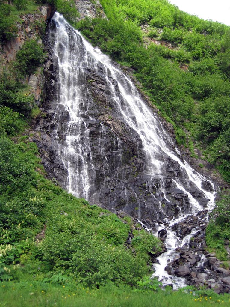
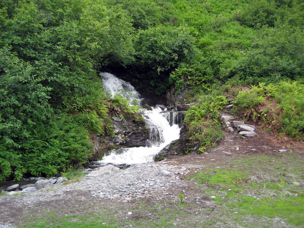
The mountains rise directly up from the backside of Valdez, and have their own waterfall called Salmonberry Falls.
Salmonberry Falls
The bottom of Salmonberry Falls
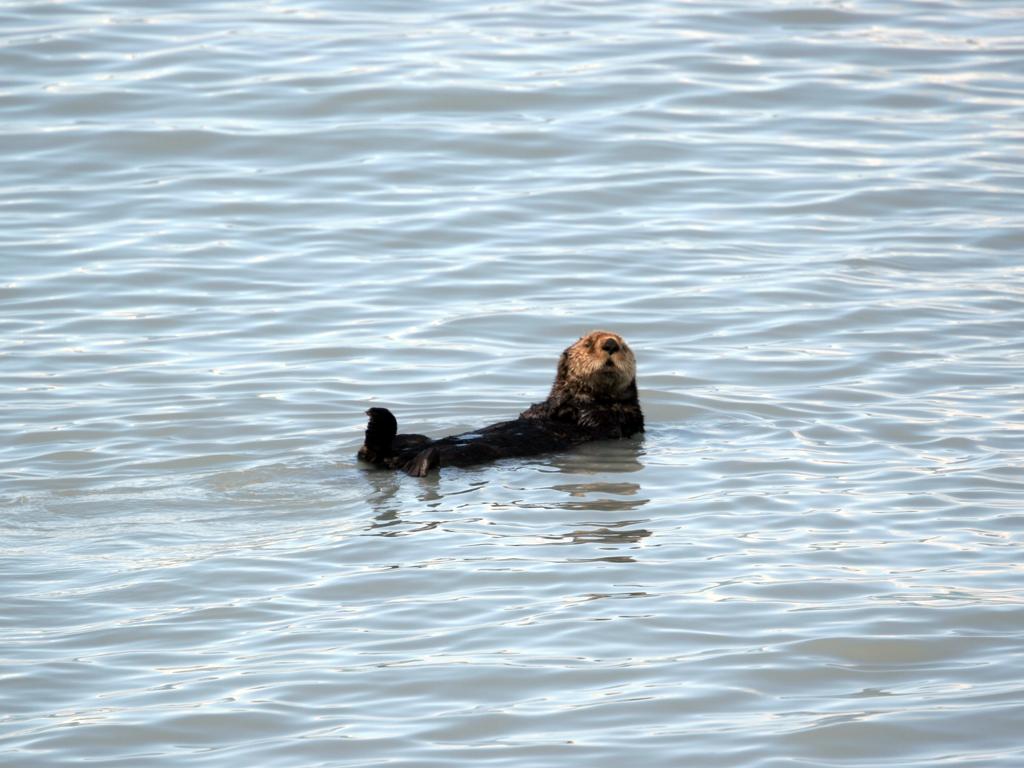
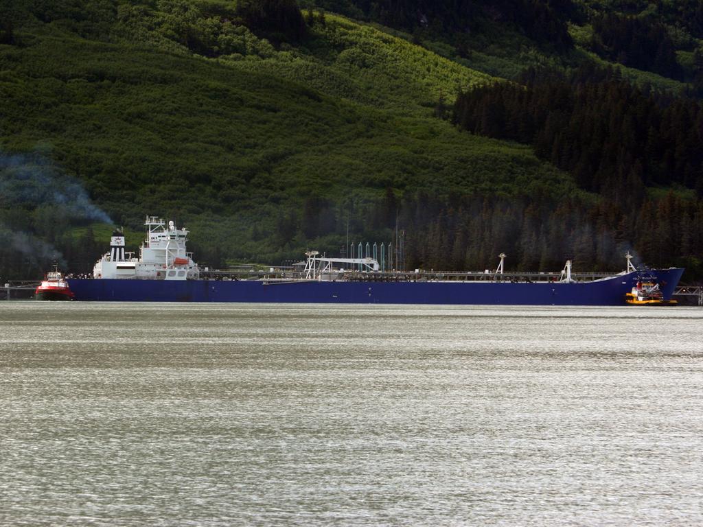
We spent one of our days in Valdez on a day cruise in Prince William Sound. Valdez is located on a long bay called Port Valdez, and we saw our first wildlife shortly after leaving the dock, as we passed many sea otters laying around on the surface.
Port Valdez includes the terminus of the Alaska Pipeline, and the tanker below was about to sail with 1.2 million barrels of crude (according to our captain).
Sea Otter in Port Valdez
Tanker at the Valdez oil terminal
On the right is the high-speed catamaran ferry M/V Aurora, part of the Alaska Marine Highway System, headed from Valdez to Whittier.
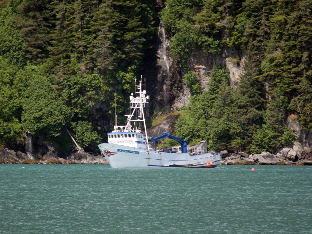
Below is the Northwestern, one of the boats featured on the Discovery Channel's program Deadliest Catch.
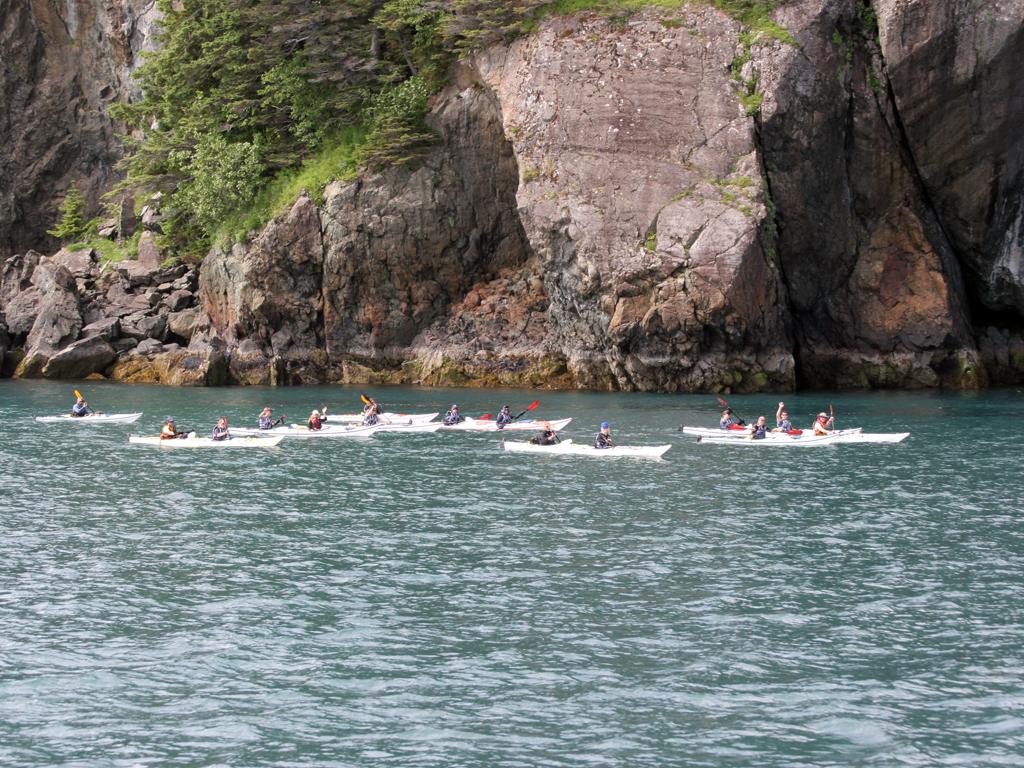
Below right are a large group of kayakers headed into Port Valdez.
M/V Aurora leaving Valdez for Whittier
Fishing boat Northwestern at the mouth of Port Valdez
A group of sea kayakers near the mouth of Port Valdez
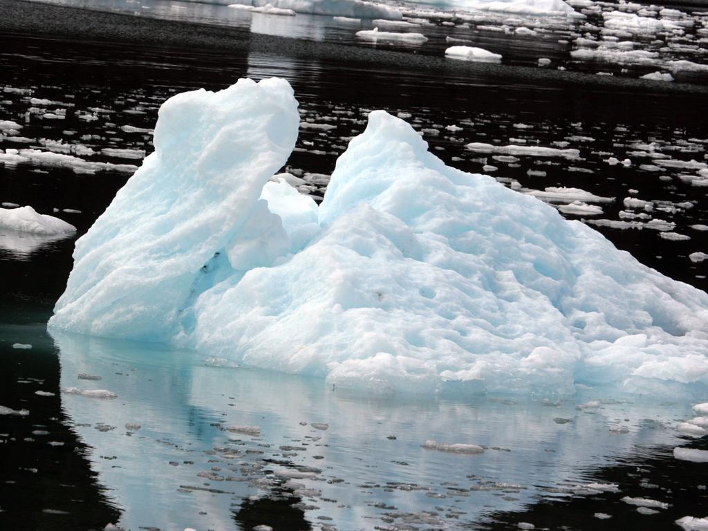
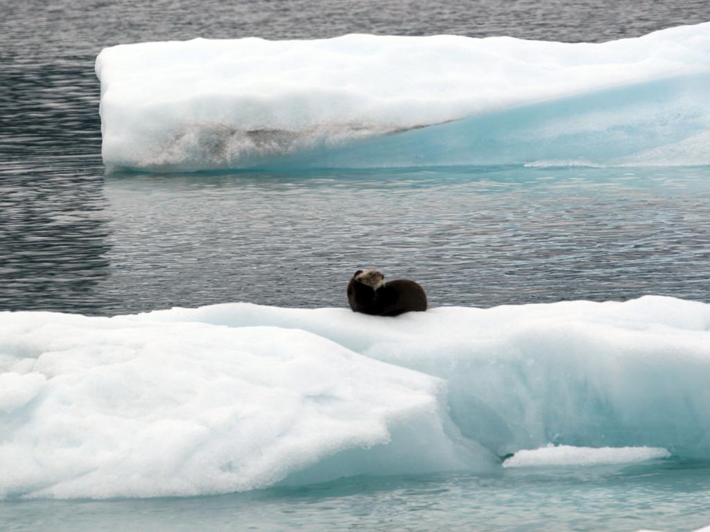
We were only able to get within a couple of miles of the face of Columbia Glacier due to the density of the ice field leading away from it. We saw thousands of icebergs of all sizes, with the boat pushing through, slowly, some fairly dense places.
Iceberg near Columbia Glacier
Sea otter on ice near Columbia Glacier
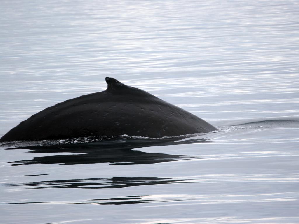
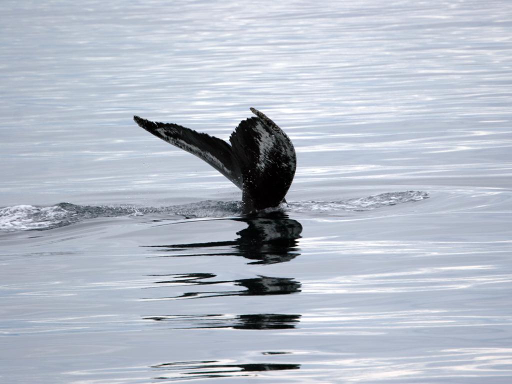
We saw two humpback whales, both of which dove shortly after we spotted them. I got the one below with the still camera, and the other on video.
Humpback whale, Prince Williams Sound
Humpback whale, Prince Williams Sound
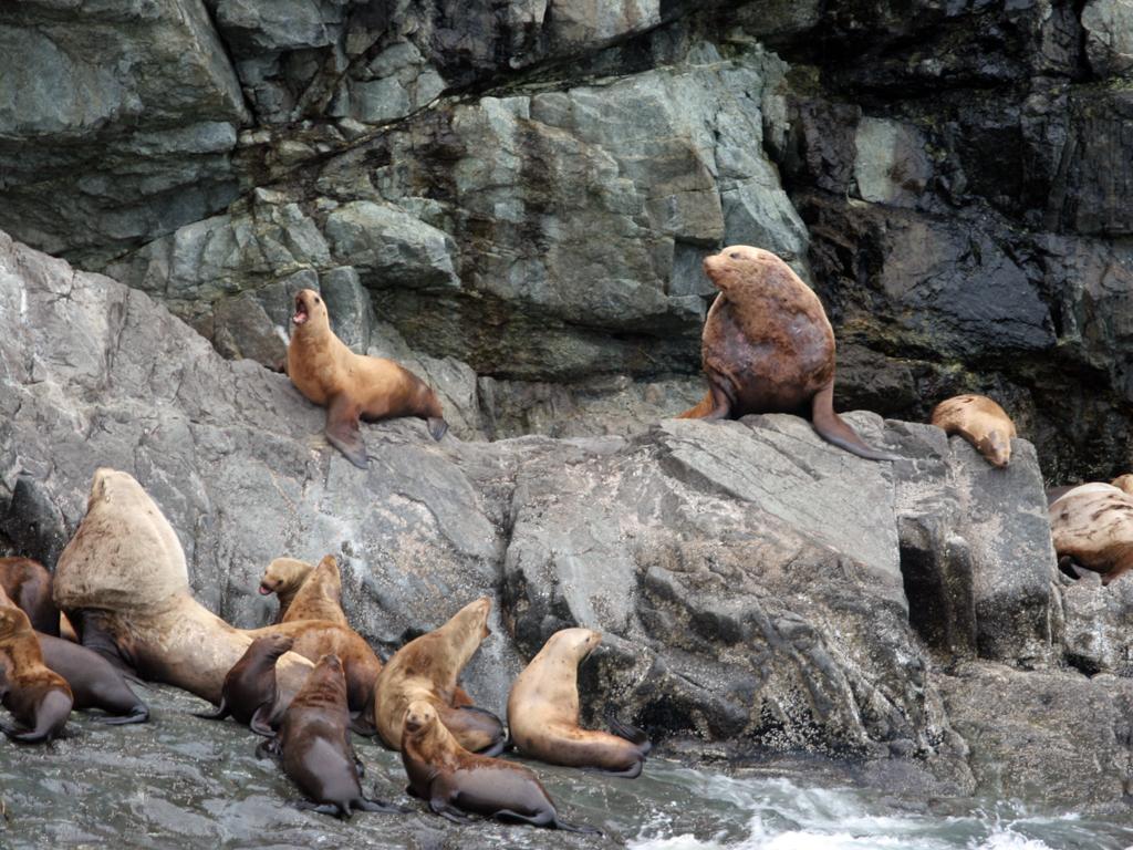
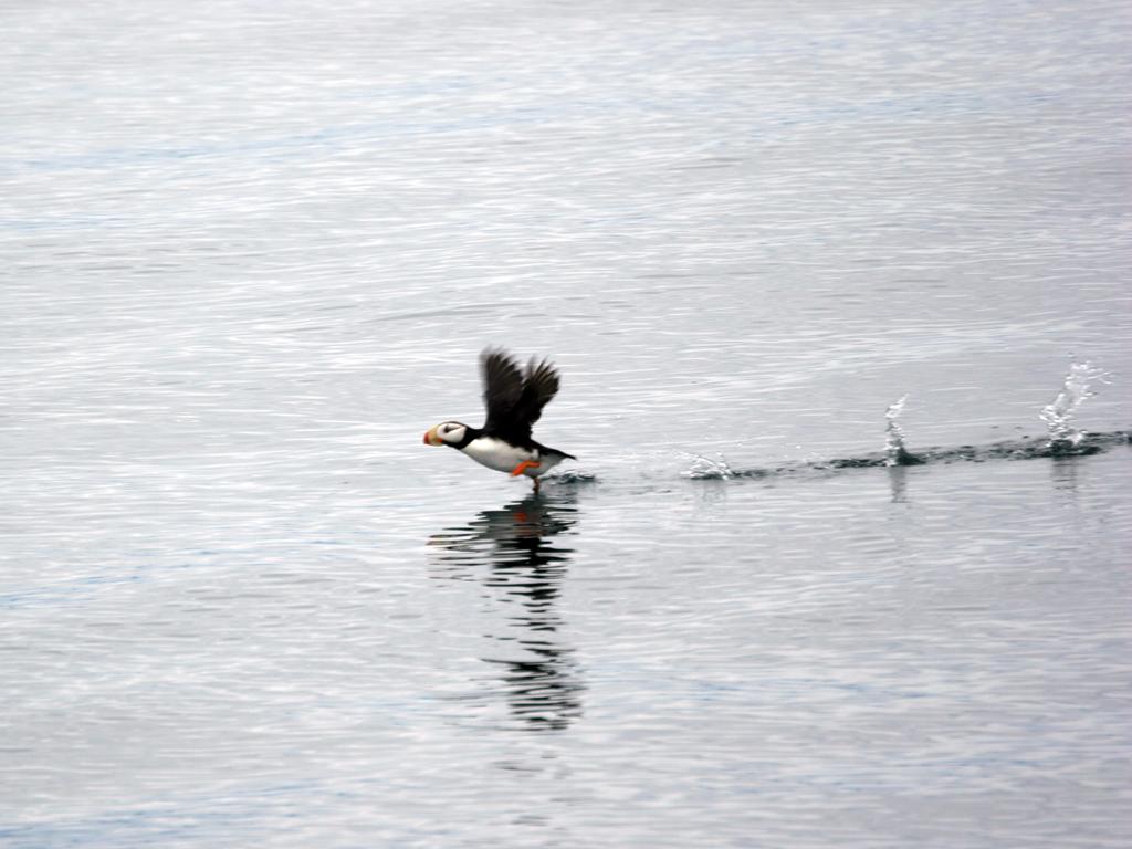
Two of the animal types in great abundance were sea lions and puffins.
Sea Otters near Glacier Island
Puffin on Prince William Sound
This is a marker on Bligh Reef, where the Exxon Valdez went aground.
Marker on Bligh Reef.
Dall's Porpoises in Prince Williams Sound
Twice we had schools of Dall's Porpoises playing in our bow waves.
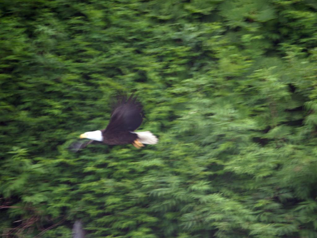
Below is a waterfall as we re-entered Port Valdez. We saw a number of bald eagles, and I caught this one (barely) in flight.
Waterfall at entrance to Port Valdez
Bald Eagle in Port Valdez
Thursday, June 30th
Our original plan was to take the ferry from Valdez to Whittier and then down further on the Kenai Peninsula. After the issues with the ferry crossing the Yukon, and looking at the way they loaded/unloaded the ferries in Valdez, we decided to take the long way around, backtracking to Glennallen and then across to Anchorage and down.
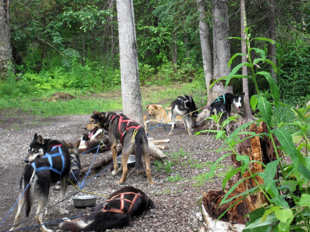
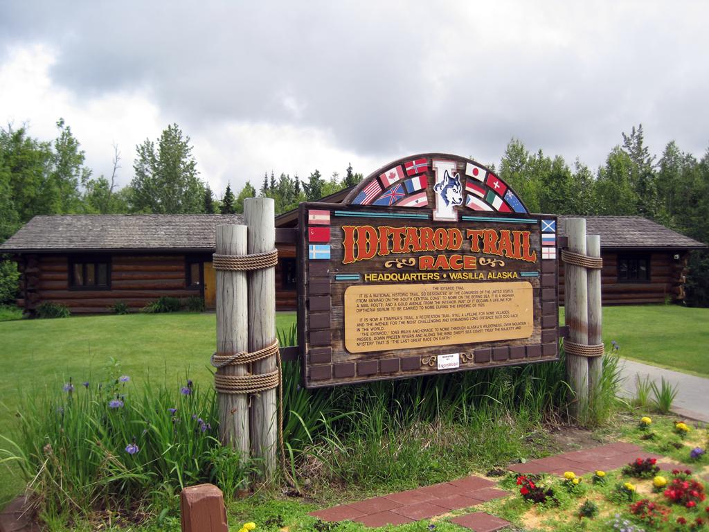
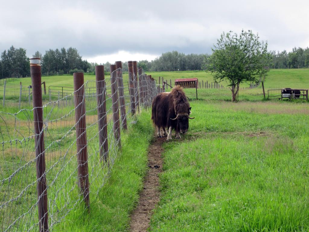
We spent the 4th of July weekend in Palmer, traveling down to Anchorage for some shopping, and visiting a few sites in the Wasilla/Palmer area. That included the Iditarod Trail Race headquarters and a Muskox farm.
Dogs in harness at the Iditarod Race headquarters
Iditarod Race headquarters in Wasilla
Muskox farm near Palmer, AK
Moose cow with two calves
Tuesday, July 5th
Next stop was in Portage, near the end of Turnagain Arm. As we approached the RV park we saw this moose cow, presumably skinny because she had two calves.
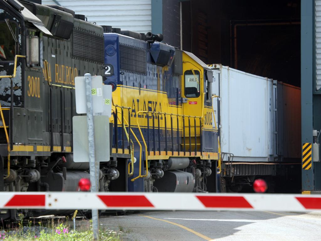
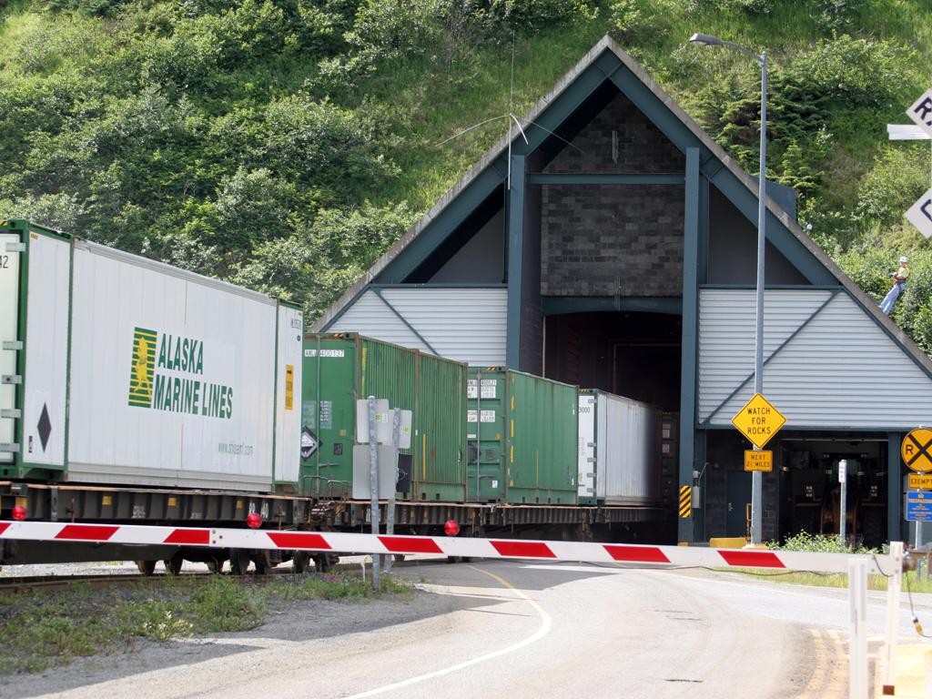
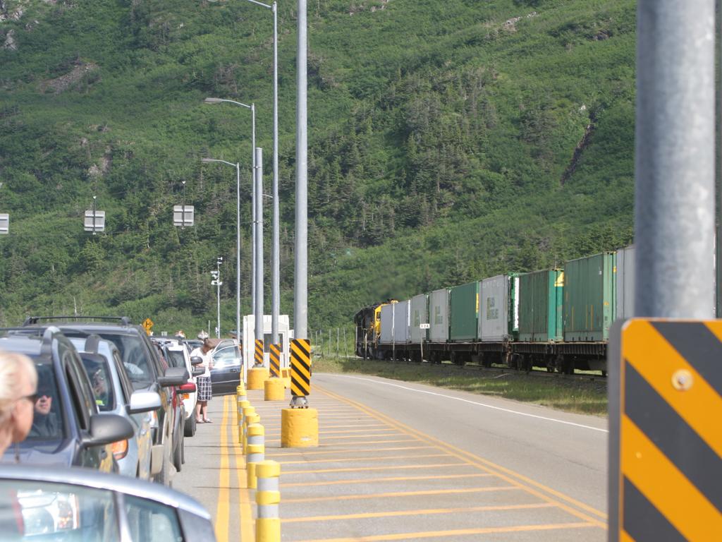
From Portage it is a short-but-interesting 6 mile trip to Whittier, on the other side of the peninsula.
You get there by traveling through a 2-1/2 mile train tunnel that is open hourly to one-way road traffic. On the way back we were first in line, with a scrolling sign that said "Next release at 5:00 pm"
Shortly before 5 it changed to "Train approaching - release time will be updated after the train clears."
It was a very long train, and there isn't much track between the tunnel and the end of the line, so it used most of it. We had quite a backup of cars behind us when we finally were able to proceed.
Train exits tunnel on the Whittier side
Train exits tunnel on the Whittier side
Lineup waiting for train to pass.
A low-resolution video of the entire East-West passage through the Whittier rail/auto tunnel. The camera was on a pad on the dash, and there is a lot of reflection of the cloth pad, particularly when in sunlight at each end of the tunnel.
Marina at Whittier, AK
Whittier is a very small town with a lot of activity in the summer. It is right up against the mountains, with glaciers everywhere you look. Lots of waterfalls.
Glacier above Whittier
Waterfall with large snow masses near the Whiiter tunnel
On the Portage side of the tunnel is Portage Lake, fed by several glaciers. Portage Glacier can just barely be seen over the ridge at right center in the photo; it calves directly into the lake and so there are many small icebergs. The one at lower right looks like a swan.
Portage Lake
Wednesday, July 6th
We spent some time in and around Soldotna, including a geocaching event on Saturday the 9th. We visited Kenai, and spent some time near the Kasilof River with folks out of Anchorage who just bought a Blue Bird coach.
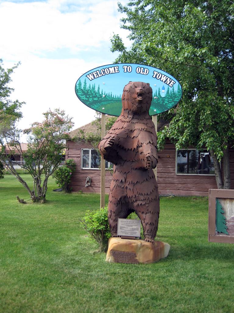
Bear sculpture at the Kenai visitor center
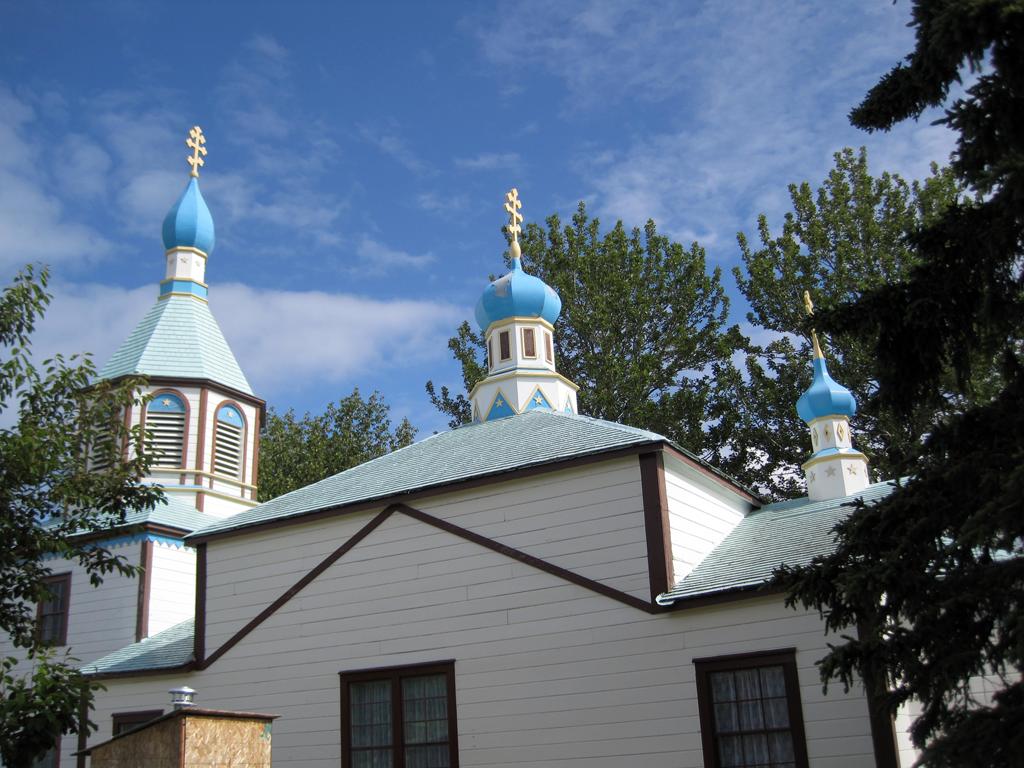
Russian orthodox church in old Kenai
Sunday, July 10th
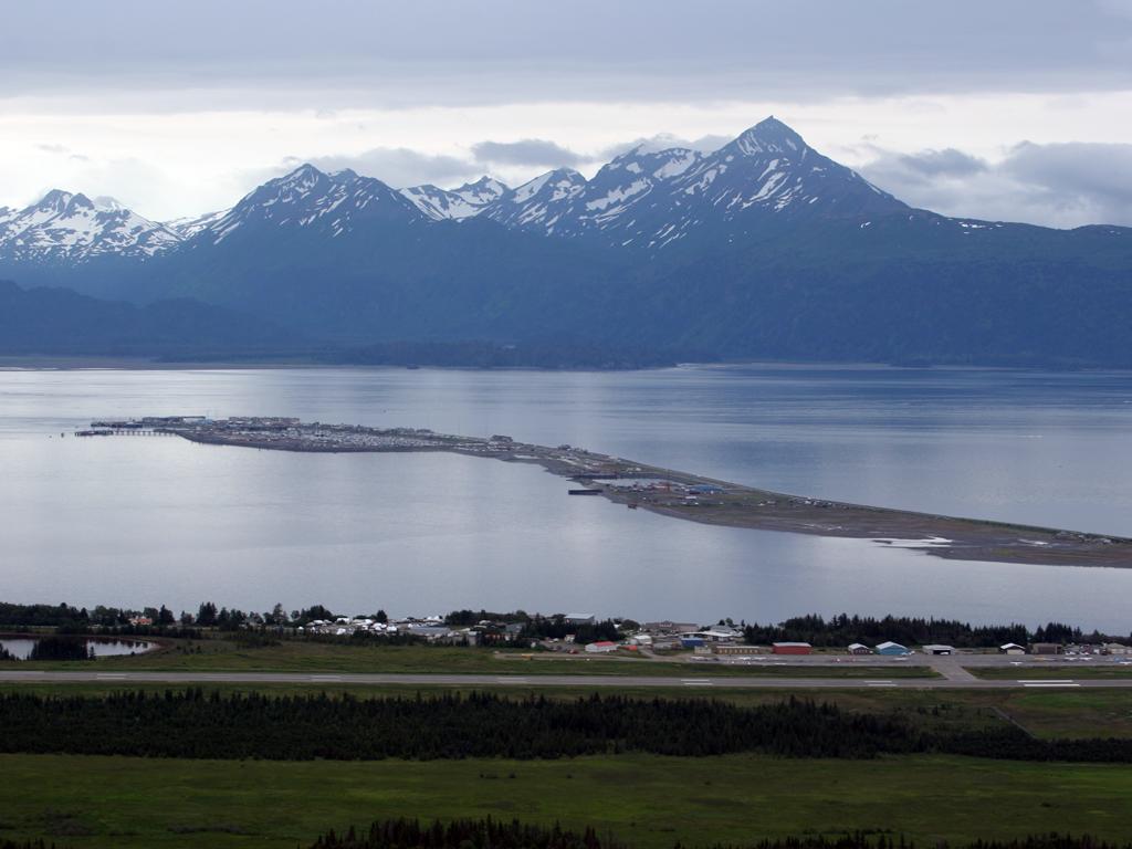
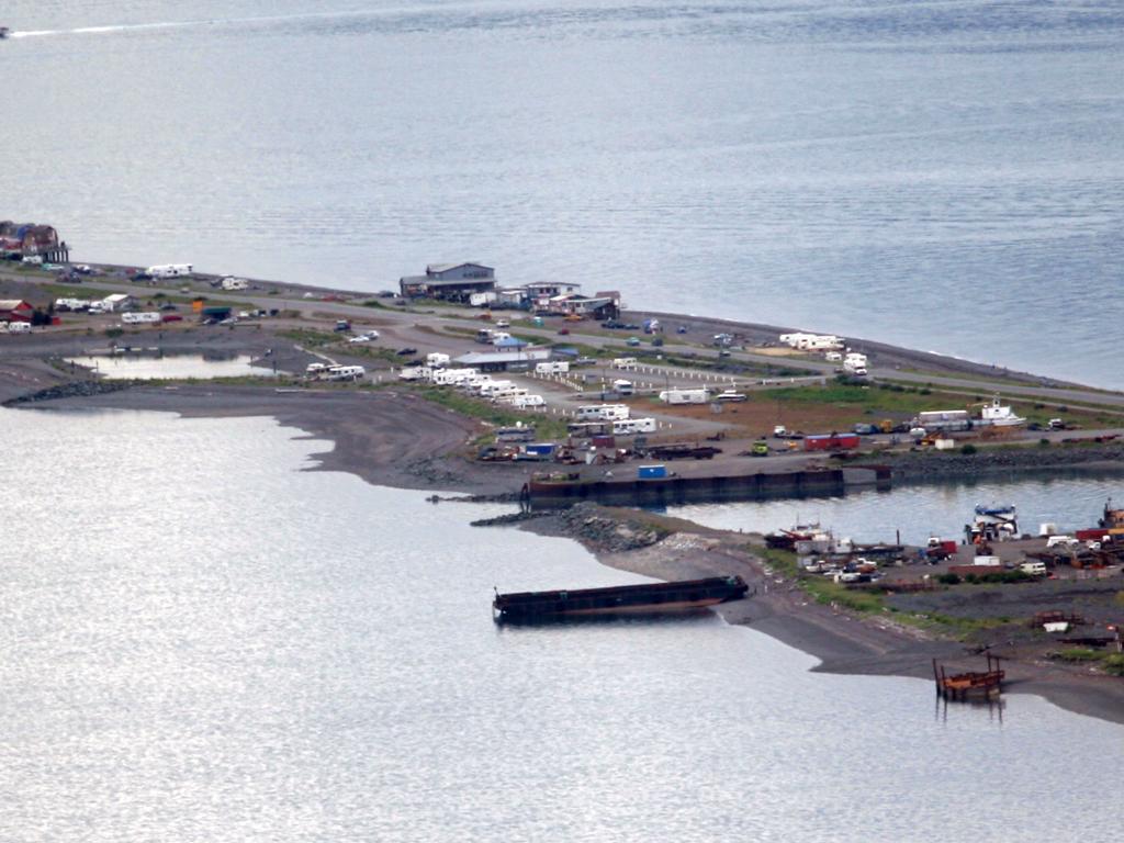
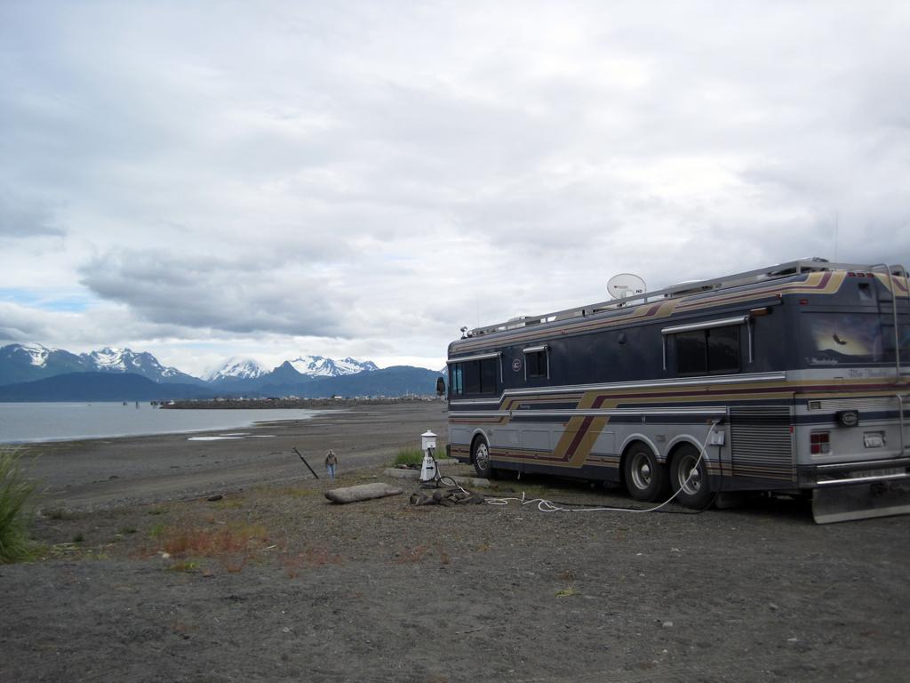
We arrived in Homer, which is about as far as the roads go in South Central Alaska. The Homer Spit demarcates Kachemak Bay to the left (East) and Cook Inlet to the right.
In the picture below left if you click on it to see the larger version you can just make out our bus at the center of the picture.
Both of the long shots were taken from Skyline Drive, which is above Homer.
The Homer Spit
The Homer Spit
Parked on the Homer Spit
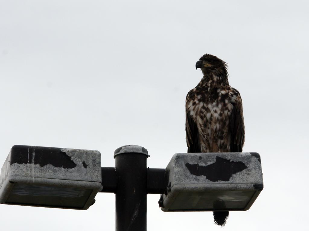
Juvenile bald eagle on a lampost at the RV park on the Homer Spit.
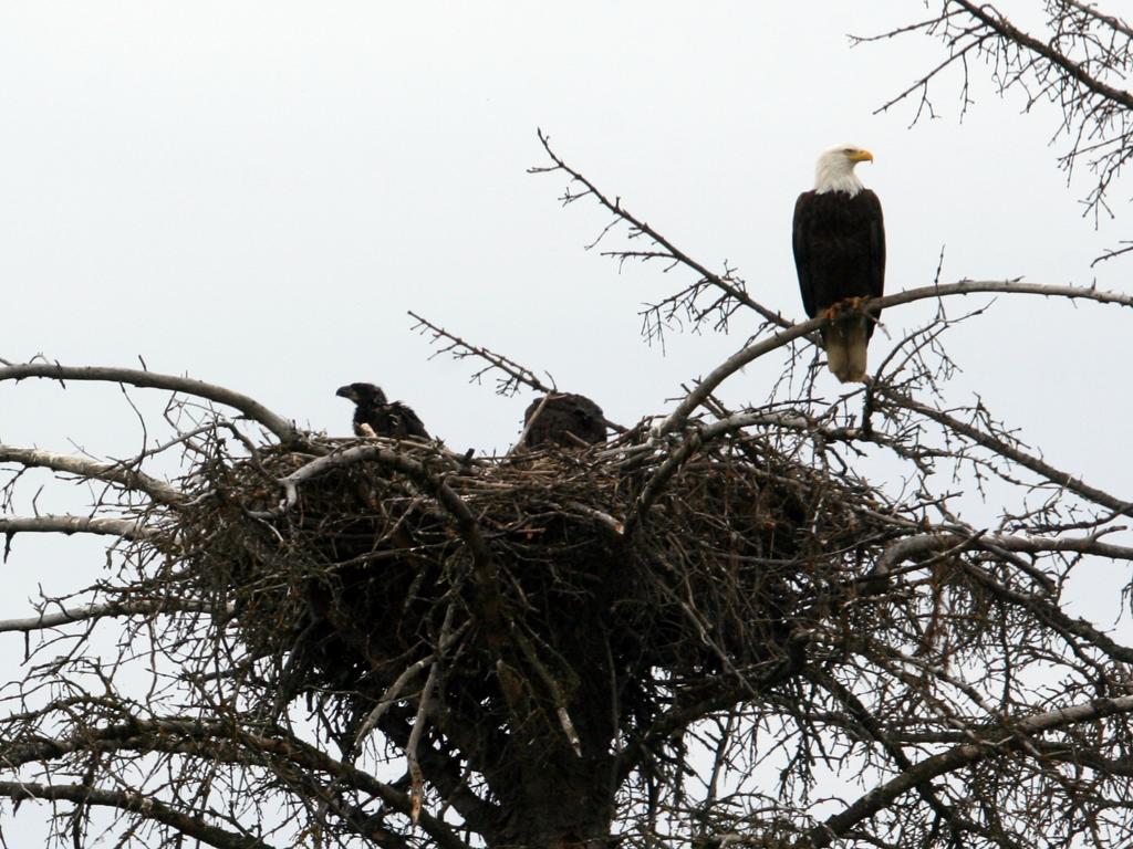
Bald eagle nest with two chicks in Homer, AK
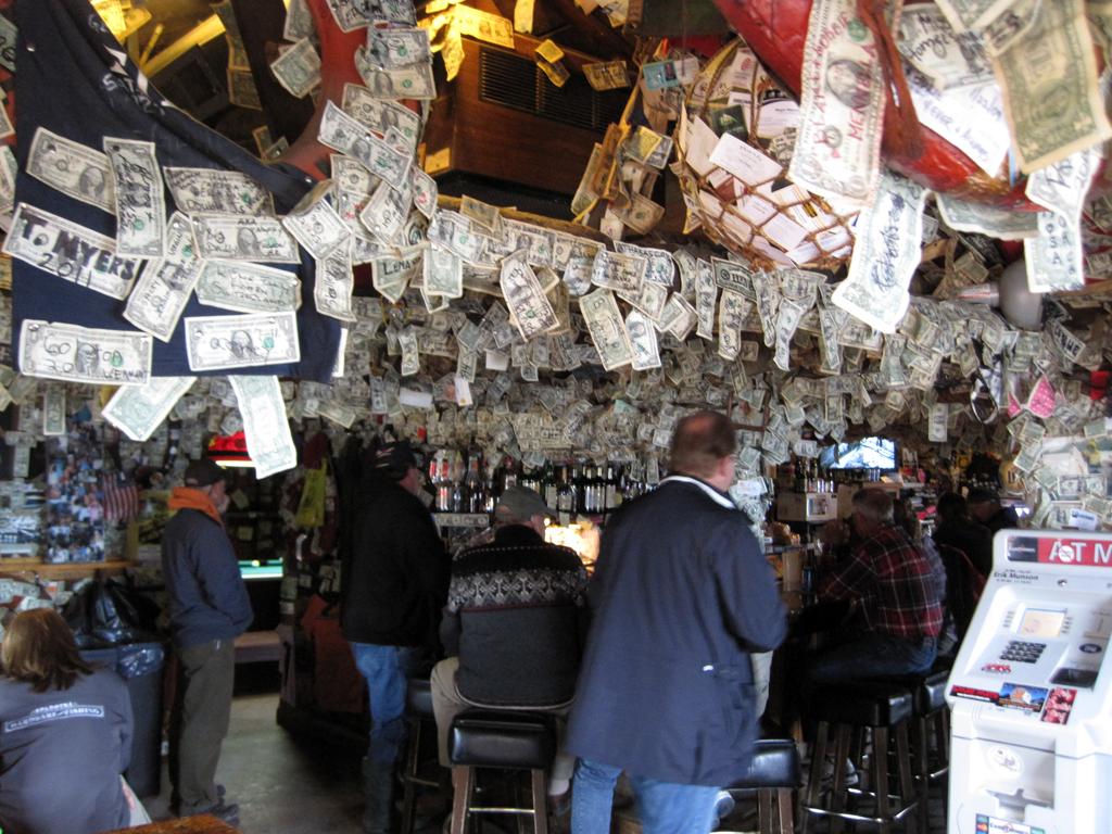
Salty Dawg Saloon on the Homer Spit, Homer, AK
When you tell people you are on the Homer Spit, half of them ask "Have you been to the Salty Dawg Saloon yet?"
So, after a great Halibut fish and chips lunch at Captain Pattie's, we walked down and took this picture inside that unique establishment.
Thursday, July 14th
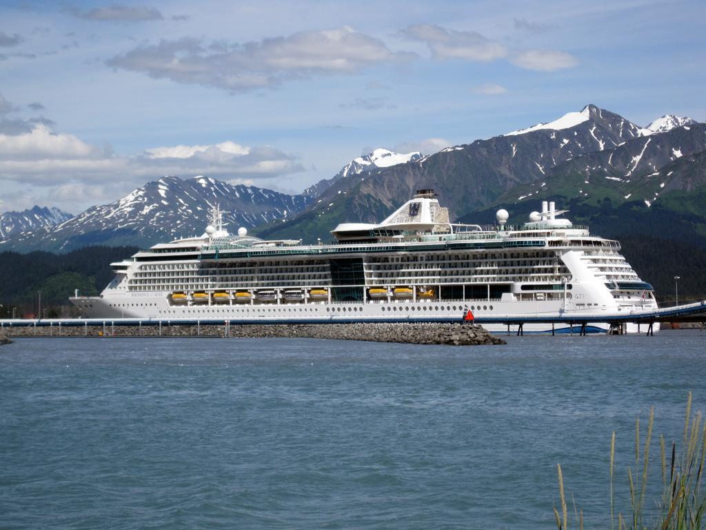
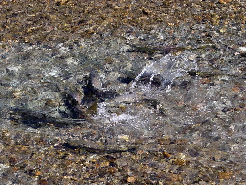
We drove from Homer to Seward, on the other side of the Kenai Peninsula and on the edge of Kenai Fjords National Park. We visited the Exit Glacier, the Alaska SeaLife Center, and watched salmon swim up bear creek.
Two cruise ships docked during our stay.
Exit Glacier near Seward, AK
Salmon below culvert on Bear Creek near Seward
Cruise ship Radiance of the Seas docked in Seward
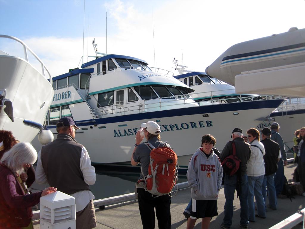
We did not find suitable pet-sitting for Nikki, so I took a glacier cruise alone. I chose a long trip out to Northwestern Glacier on the Kenai Fjords Tours boat Alaskan Explorer.
Alaskan Explorer
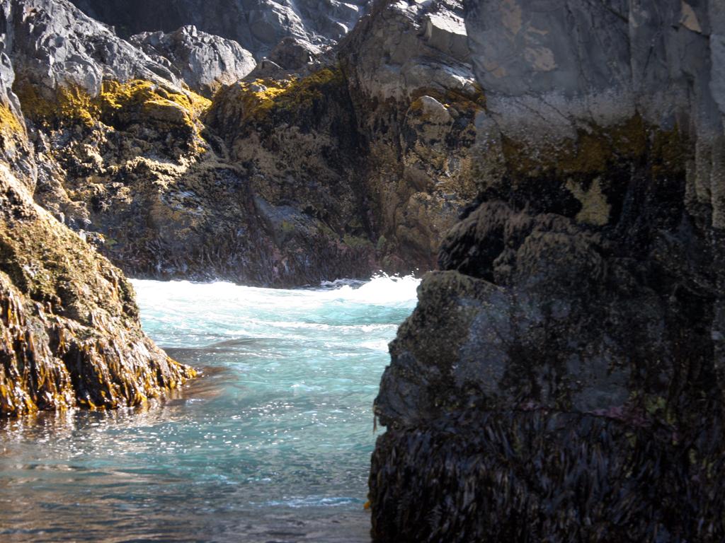
During the trip to Northwestern Fjord we poked into several coves and among sea stacks, with lots of wildlife seen.
Sea stacks in Kenai Fjords National Park
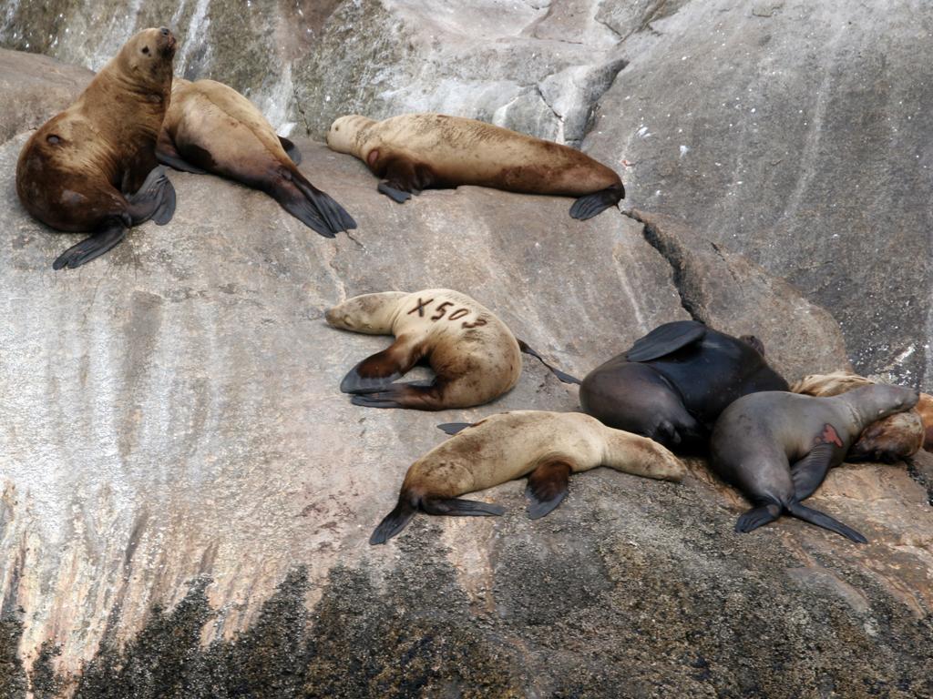
Sea Lions in Kenai Fjords National Park
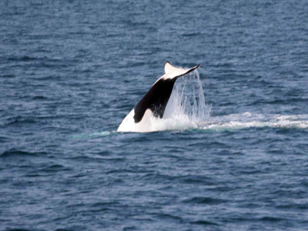
Orca playing near the mouth of Resurrection Bay
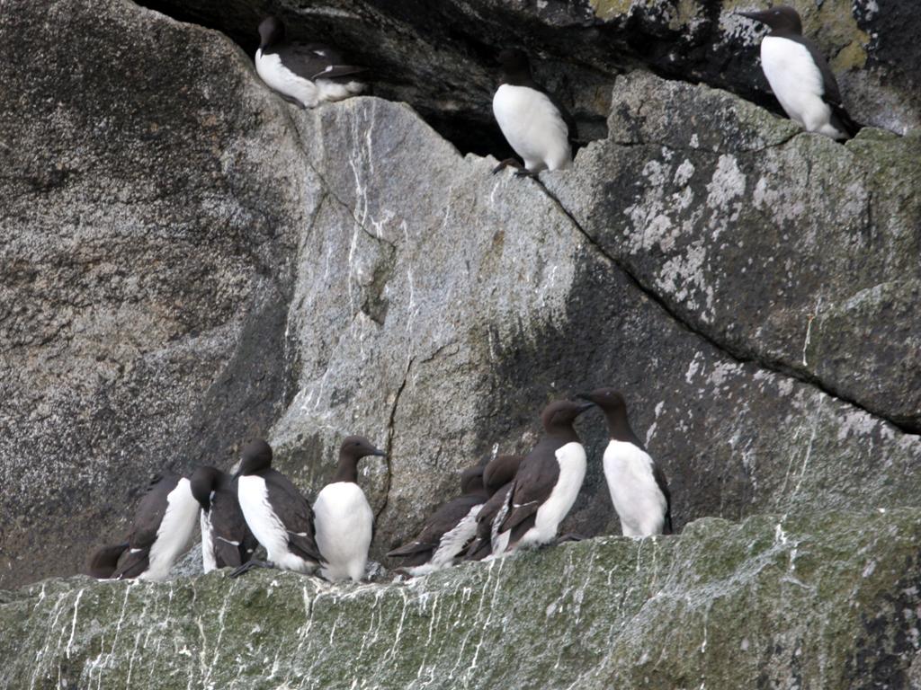
Murres nest high on rocky ledges
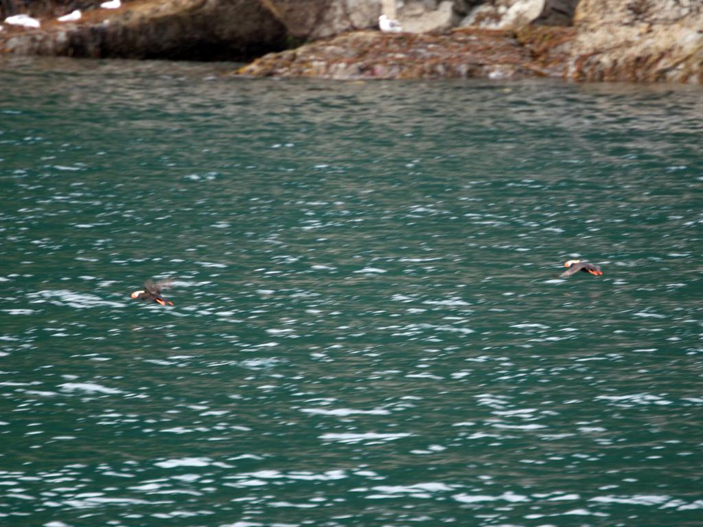
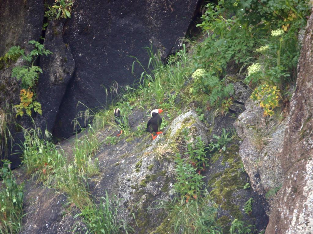
Lots of horned and crested puffins, both on the water and nesting on the cliffs.
Puffins fly near Seward, AK
Crested Puffins nest in the grassy areas at the top of cliffs
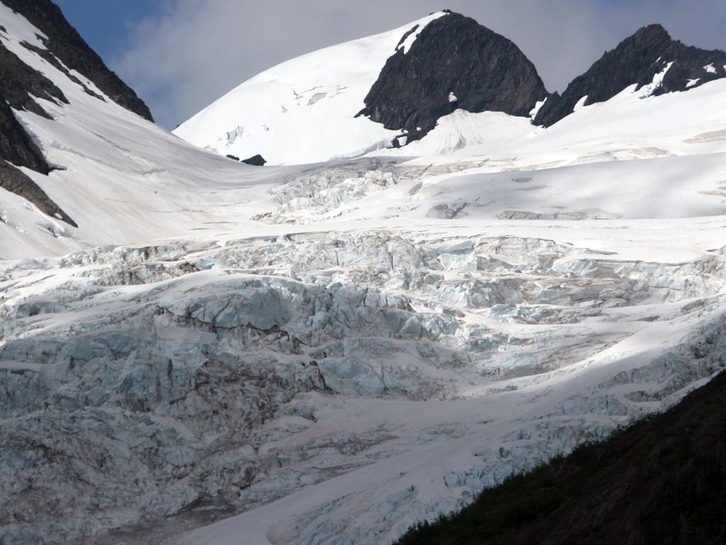
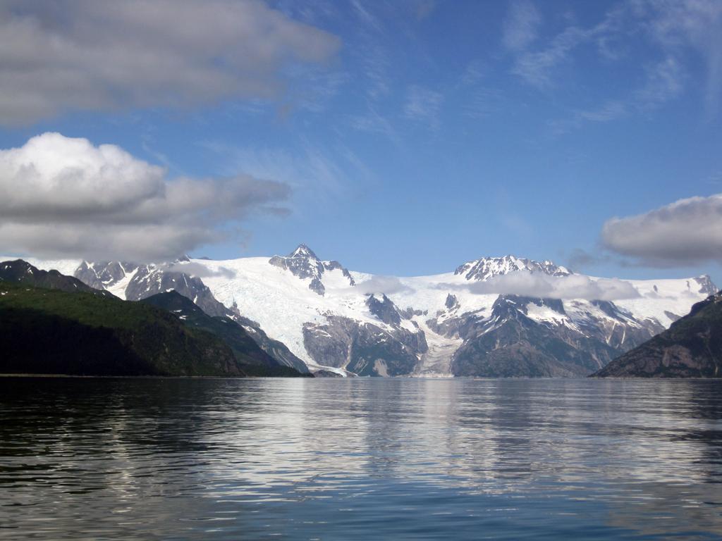
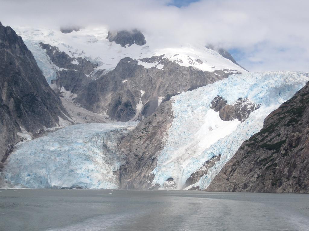
We passed numerous glaciers on our way to the Northwestern Glacier. Northwestern (named after the university) has a particularly high and steep face, which makes the ice falls quite spectacular.
Smaller glaciers that flow into Northwestern Fjord
Northwestern Glacier at the head of Northwestern Fjord
Ice fall at Northwestern Glacier
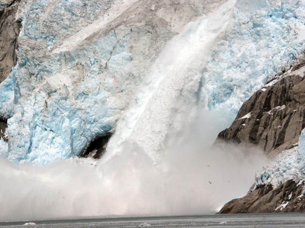
We were able to see 3 icefalls, one as we arrived, and another (left) that occurred as we were departing.
The one that happened while we were stationary in front of the glacier I was able to photograph from beginning to end. In the Youtube video below, the first six seconds are rapid-fire still shots of the glacier calving, and then the video begins. If you look closely you can see it turns into an avalanche, then flows over the edge as an icefall.
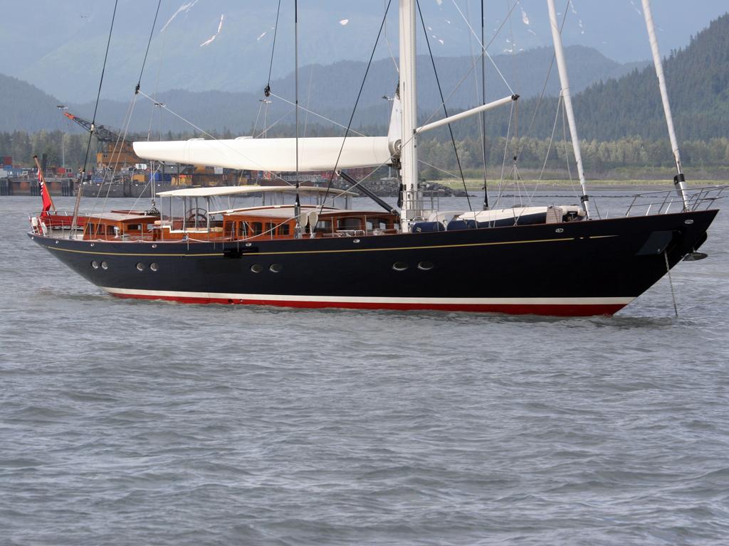
Returning to Seward we passed the 172-foot luxury sailing yacht Erica XII, which had passed us coming into Resurrection Bay as we were headed out in the morning.
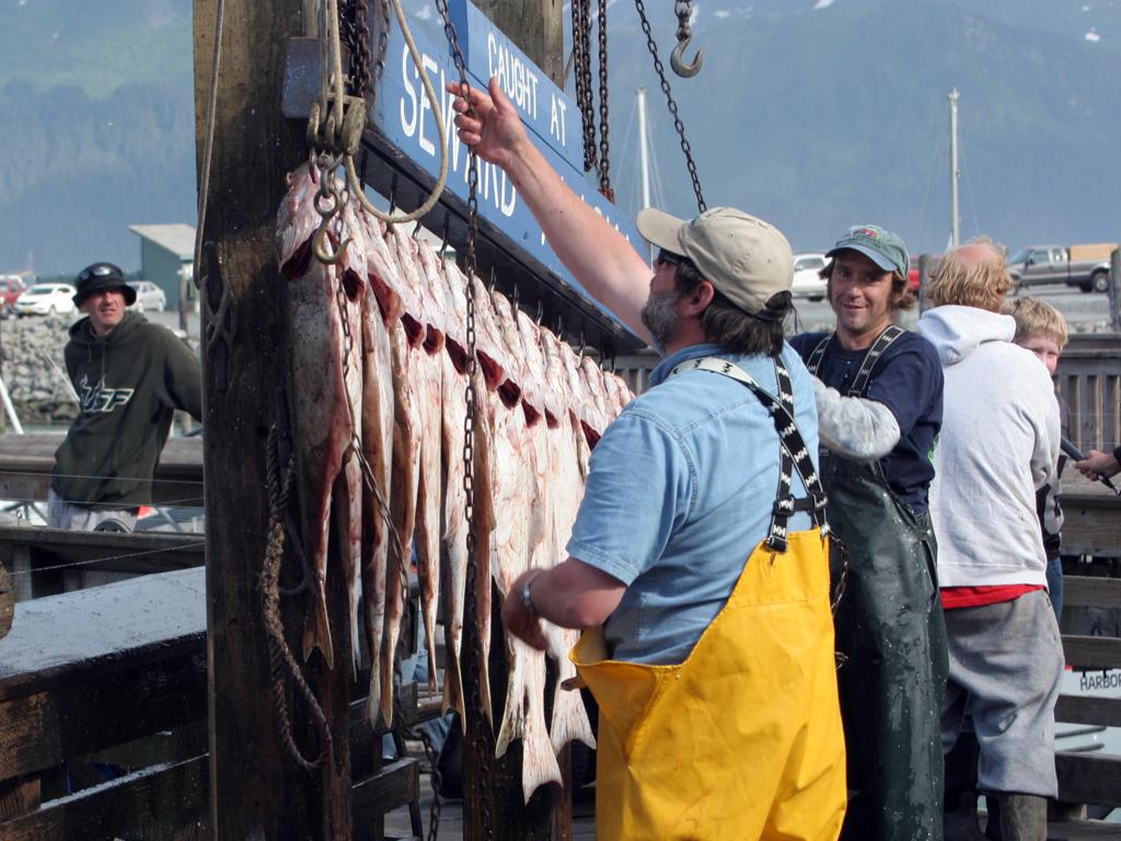
We returned around the same time many of the fishing charters were returning.
S/Y Erica XII anchored off the Seward Marina
Fishermen with the catch at Seward, AK
Sunday, July 17th
A few weeks back in Tok we saw this 92 Blue Bird pulling out of a fuel stop in Tok (we were in our Jeep). As it happens they pulled into the RV park where our bus was parked to use the pressure washer, and saw ours; they left a note with their phone number.
We spent some time with them later in Kasilov where they were fishing (did not have their coach with them), and they invited us to stay at their place when we passed through Anchorage. We spent a couple of nights there, and helped a bit with deciphering some of the complex Blue Bird systems, as they are new owners.
They served us an excellent salmon dinner!
92 Blue Bird Wanderlodge in Anchorage
Tuesday, July 19th
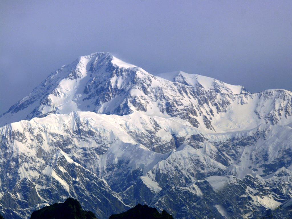
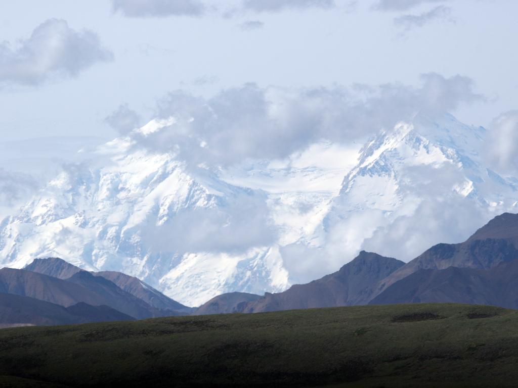
One of the goals for visiting Denali National Park is "to see the mountain (McKinley)," and one of the better places to see it is from the town of Talkeetna, outside the park. A high percantage of visitors to Denali never see the peak, or even very much at all, due to persistent clouds. That is how it was on our afternoon visit on Tuesday. The left picture has Mt Foraker in the background, at 17,400 feet it is the second highest in the Alaska Range.
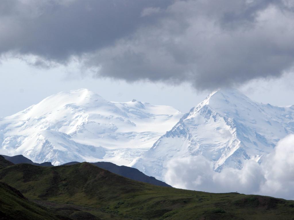
Our second run into Talkeetna on Wednesday morning provided a really clear view of the entire range. This telephoto shot of Mt McKinley is from about 60 miles, and correcting for the slight haze produced the bluish tint that I decided to leave in.
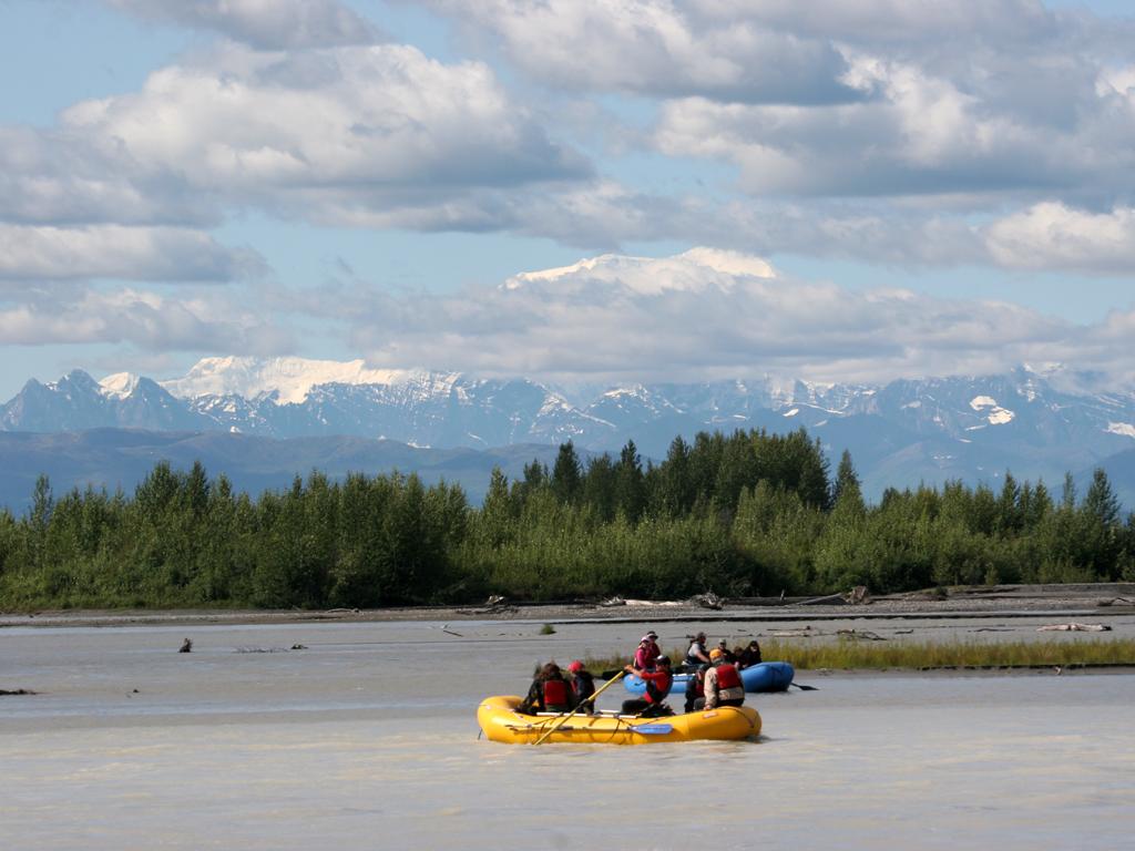
Rafters in the Susitna River near Talkeetna
Morning shot of Mt McKinley from near Talkeetna
Thursday, July 21st
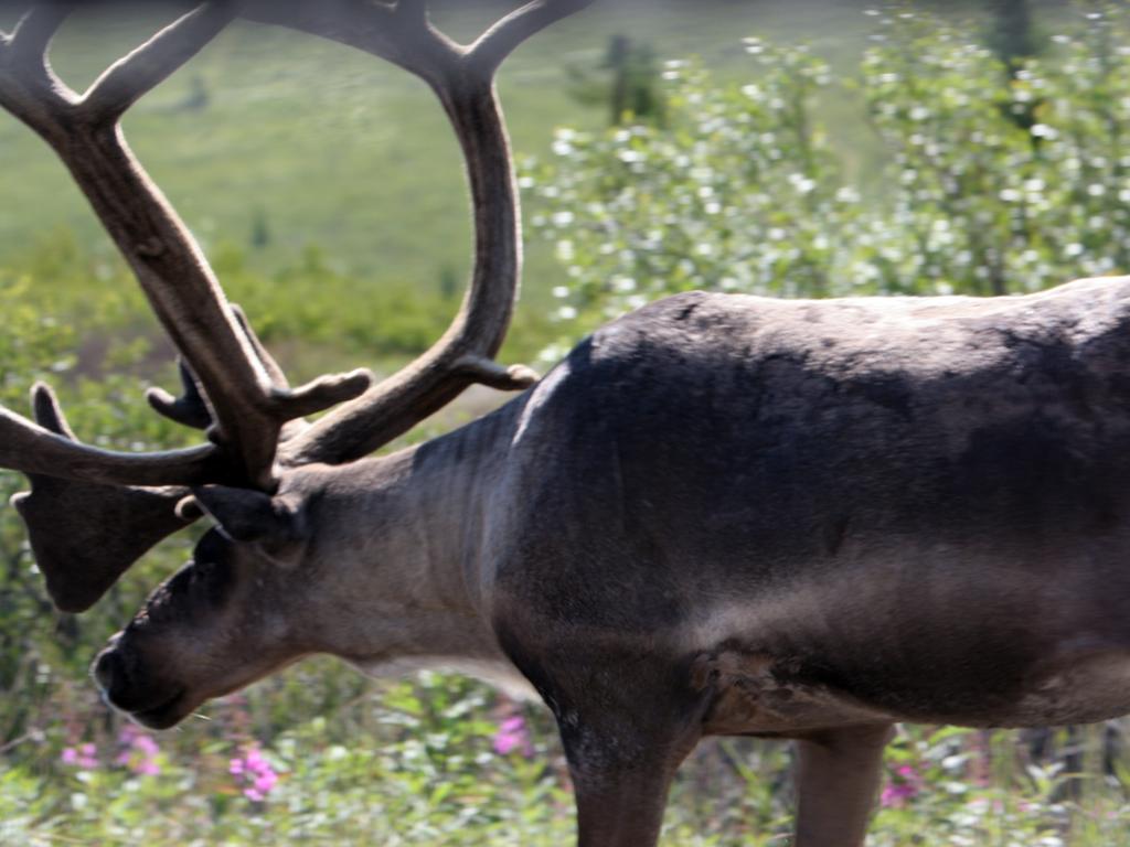
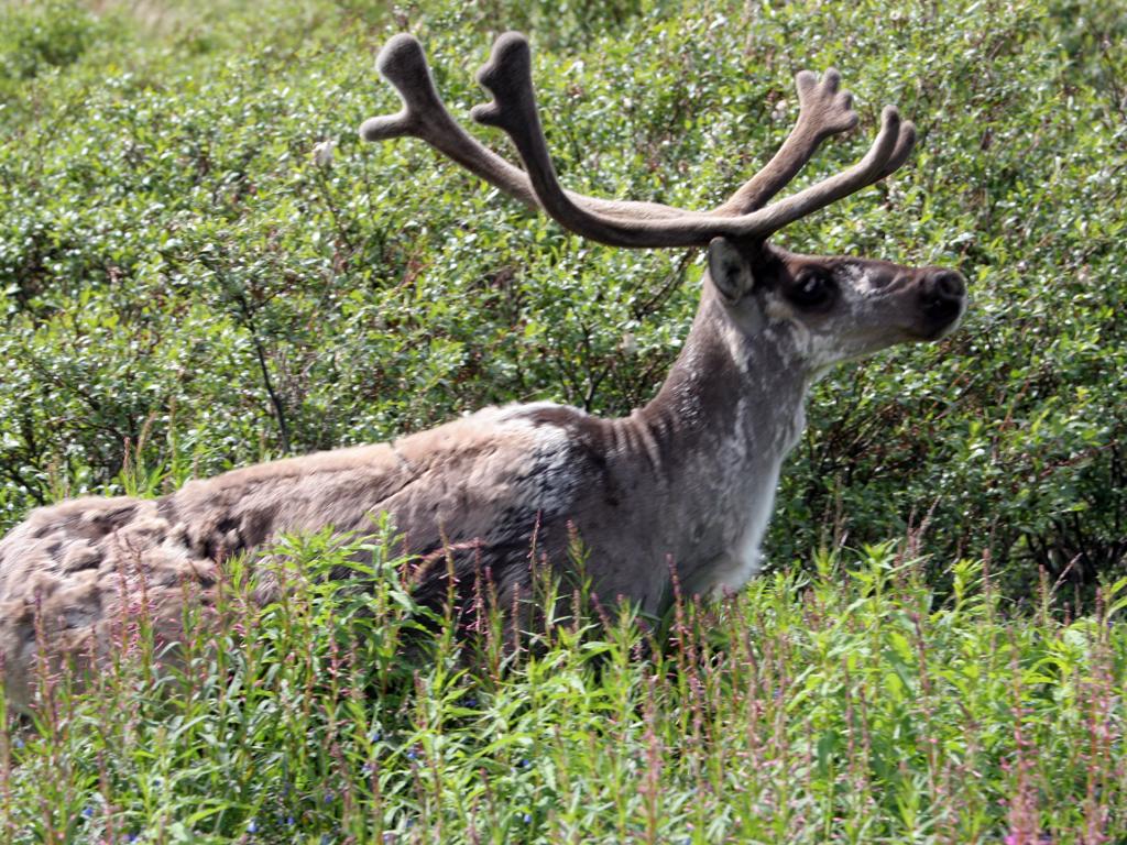
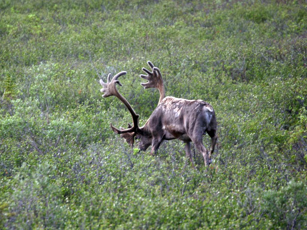
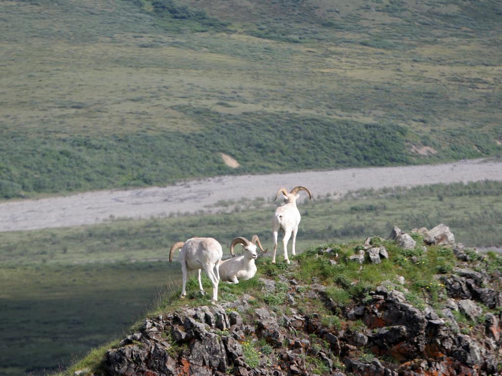
We took the park shuttle to Eielson, 132 miles round-trip in about 8 hours. We saw many caribou and Dall sheep, a few grizzlies, and one bull moose. Also many views of Mt McKinley, all with at least some cloud cover but not bad by local standards.
Denali National Park shuttle bus
Caribou in Denali National Park
Caribou in Denali National Park
Caribou in Denali National Park
Bull moose in Denali National Park
Dall sheep in Denali National Park
Grizzly bear in Denali National Park
Alaska range from the Denali Park road
Alaska range from the Denali Park road
Alaska range from the Denali Park road
We stayed in an RV park in Cantwell for our visit to Denali, chosen specifically because they offered pet sitting. The owner of the park does the sitting, either at her place or taking the dog for walks from your RV.
We left Nikki with her in the morning, along with the crate we normally use in the Jeep. She was just starting out to walk to the Post Office. and had her own dog off-leach and a maltese that she was sitting on-leash. Nikki of course tried to play, and used her feet on the little maltese.
When we returned that evening, she said "We had a few disasters." The starting point was that the maltese was deathly afraid of Nikki. Then Nikki refused to go up the steps to the Post Office. When she returned to the RV park she tried to get Nikki up the stairs to her apartment and that was impossible, so she tried to put her in a room off the park office. Nikki barked continuously for an hour.
So finally, she took Nikki out to our bus and put her in her crate there (we had given her a key). All-in-all she earned her pet sitting fee!
Friday, July 22nd
Denali was our last major stop, and the trip home started. We spent a couple of days in Fairbanks, and happened to catch a local parade when we were downtown.
Parade in Fairbanks
Parade in Fairbanks
Occasionally Nikki will find a young dog that really enjoys wrestling, and that was the case in our RV park near Fairbanks. A young military couple from Ohio had a year-old lab that had just the energy that Nikki needed.
Wrestling at Fairbanks
Monday, July 25th
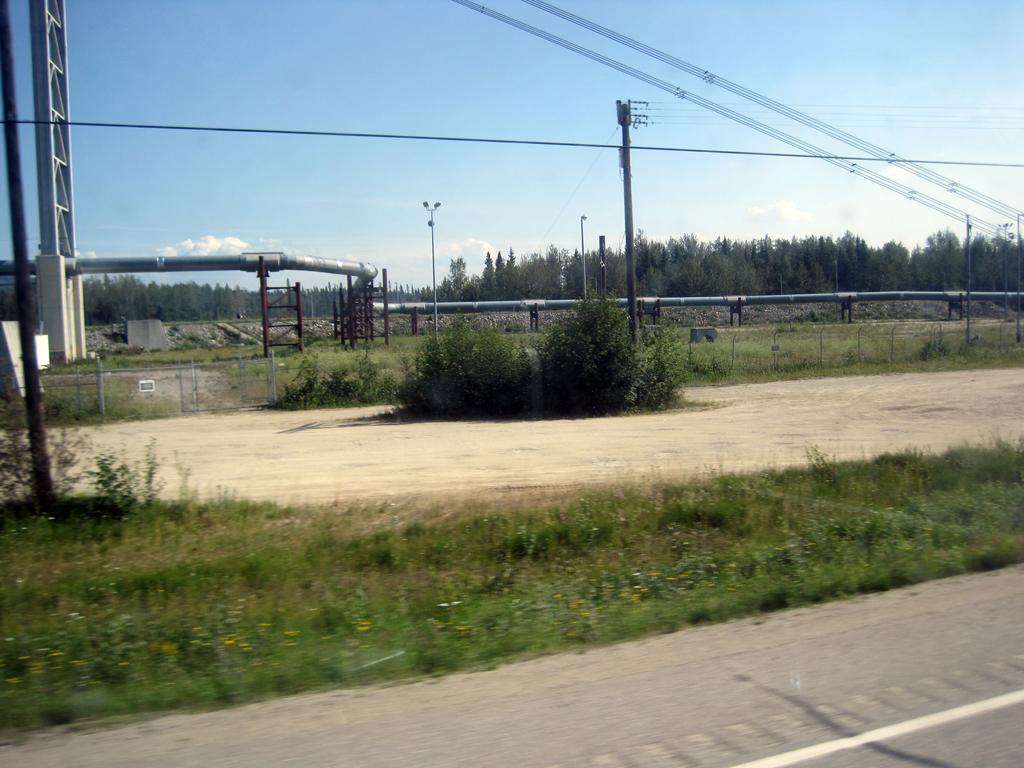
Headed west on the Alaska Highway there was a good spot to take a picture of the Alaska Pipeline. We traveled beside it a lot going down to Valdez, but didn't get any pictures. The moose cow below was quite nonchalant about traffic.
Moose west of Fairbanks
Alaska pipeline west of Fairbanks
Further west on the Alaska Highway we covered the parts east of Whitehose that we had missed going the other way when we instead went up through Dawson City. The acknowledged worst part of the highway, in terms of frost heaves, is the first 120 miles or so in the Yukon east of the Alaskan border.
I found that it is not possible with a video to properly catch just what the road feels like, but you can get just a bit of an idea what what I did capture. This video is of a stretch a bit under 10 miles long around milepost 1090:
Sunday, July 31st
Just east of Watson Lake we turned south on the Cassiar Highway, which travels down the western side of British Columbia. The weather was cool and rainy all of the way down to Stewart.
Geocaching on the Cassiar
RV Park in Iskut on the Cassiar Highway
Traveling the Cassiar Highway
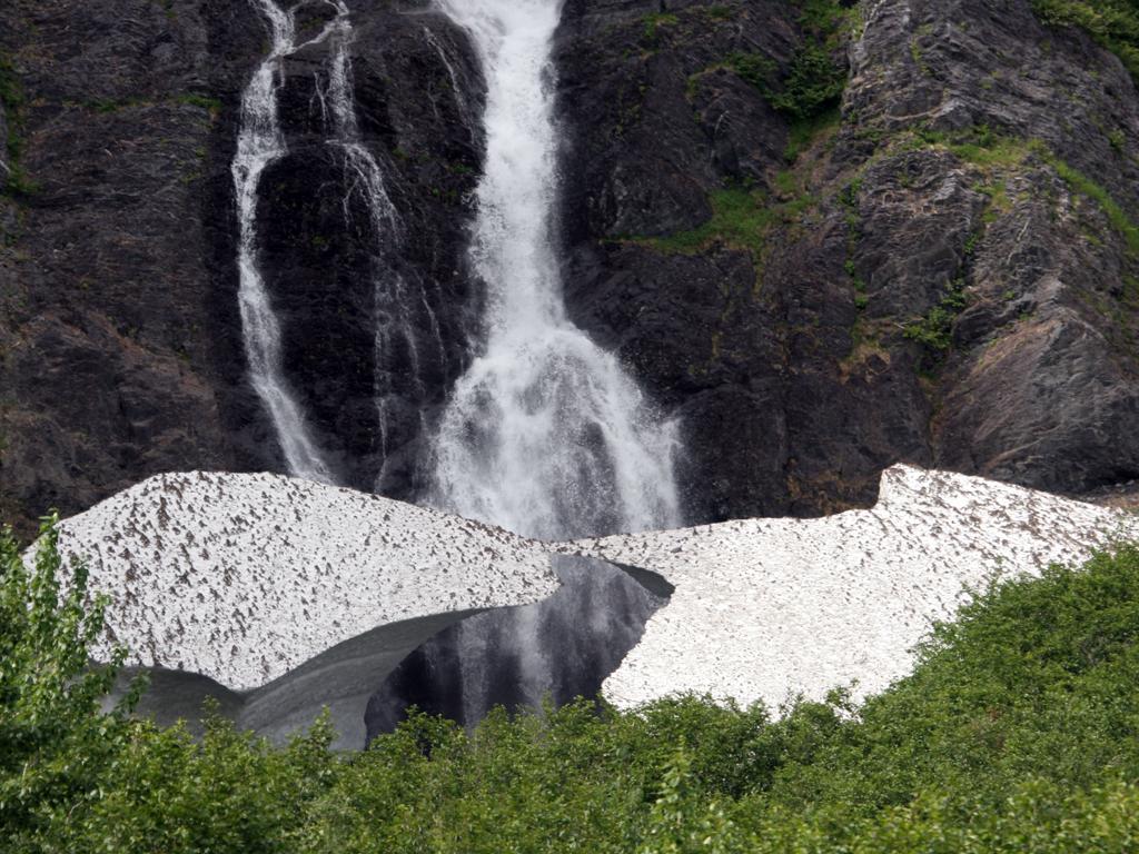
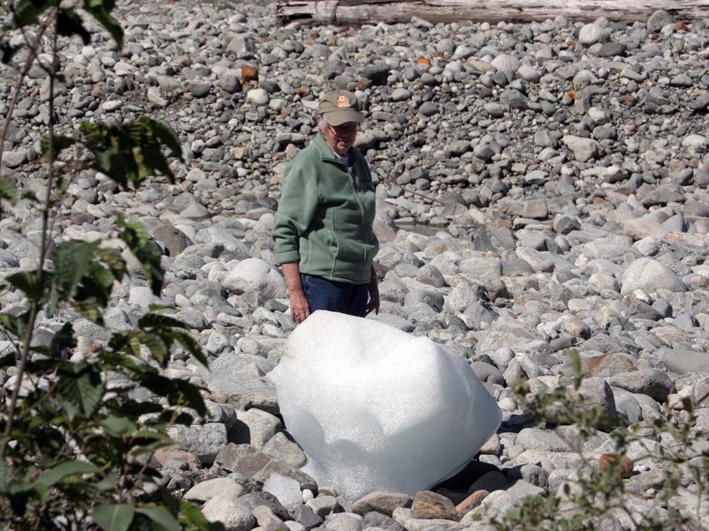
Stewart is on the border with Alaska, at the head of a long Fjord called the Portland Canal. Across from Stewart is a small town named Hyder.
The two attractions for Hyder are the bear viewing station on Fish Creek, and Salmon Glacier, 20 miles north (in British Columbia, but you can only get there from Hyder).
There were lots of salmon in Fish Creek, but no bears. On the days that we were there we were told that bears had been seen twice, one black bear and one grizzly, but for only a short period of time. There were people who stayed there all day waiting, but we did not.
On one trip back to Stewart the Canadian customs guy asked the routine "what was the purpose of your visit to Hyder" and we said "to see the bears but there weren't any," to which he responded "sure there are, look in your mirror!" A black bear was crossing the street in Hyder about 100 feet behind us.
Salmon in Fish Creek at the bear observation station north of Hyder, AK
Ice boulder north of Hyder
The bear station is about 4 miles north of Hyder, and Salmon Glacier is about 15 miles further on a dirt road with about 4000 feet ot elevaion climb.
Near the bottom Joy spotted this ice boulder below the road and had a close look at it. We think it rolled down from the other side of the road, but we aren't sure. It was miles below the glacier.
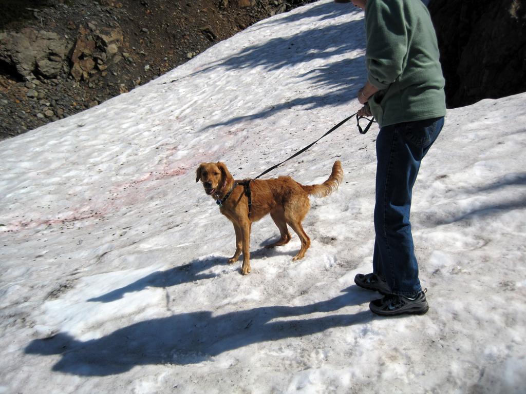
Near the top there was snow at the side of the road, so we let Nikki play in it for awhile. The short video shows her catching a snowball.
Nikki and Joy on snow north of Hyder
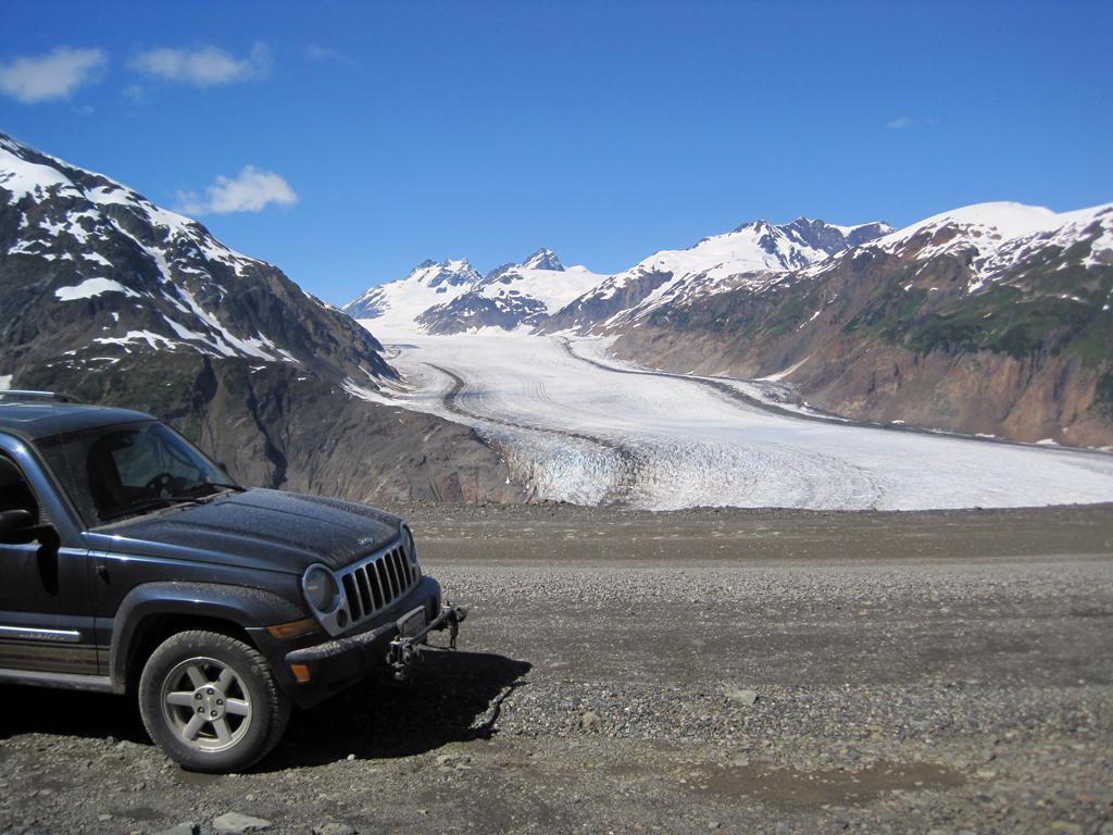
Salmon Glacier
Tuesday, August 2nd
The video below is a drive through the town of Hyder, beginning at the North end and ending at the border crossing into Canada. It is typical for the road up to the glacier.
As the trip winds down, here's a couple of pictures of Nikki in water. She is very hard to get out of the water when she finds some!
Nikki in the Columbia River at Wenatchee
Nikki in a dogpark in Wilsonville, Oregon
Here is our final wildlife count, covering the time period from when we left Prince George until we arrived back there. Ones without counts indicate that we either didn't count because there were so many, or we stopped counting because there were so many.
5 Grizzlies 9 Black Bears 8 Moose Cows 2 Bull Moose 2 Moose Calves 2 Beavers Buffalo Bald Eagles 1 Mink 1 Stone Sheep 1 Porcupine Sea Otters Sea Lions Dall's Porpoises Puffins 6 Humpback Whales Harbor Seals 7 Caribou Dall Sheep 1 Orca 6 Ptarmigan 2 Hoary Marmots Many other sea birds not listed above, including cormorants and murres.
 Comments? Send mail to donb@arcatapet.net