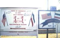
 Headquarters 
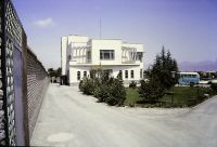 Topo House
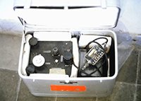 Measuring Gravity
 Aerial Sights
 Base Camps
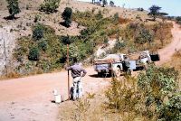
 Driving Around
 Ground Level Sights
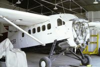
 Helicopters
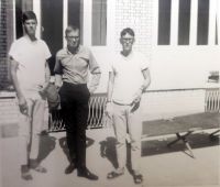
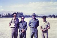 People
 Chris Jensen
 Tehran Flight Line
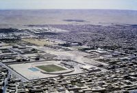
 Views Around Tehran
 Ethiopia
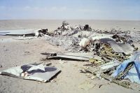 AirForceCrash Army Home Page Images Home Page |
|
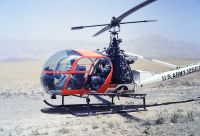
MeasuringGravityAs I've mentioned several times in other sections, my primary job in the army was measuring gravity.That is an odd job, for sure. Gravity over the surface of the earth varies only a little, but it does vary. Biggest factors are distance from the earth's center of gravity, and localized density below the spot of measurement. Highest numbers are found around the North Pole, and lowest are high in the andes on the equator (both because of the equatorial bulge and the centrifugal force of the earth's rotation). The variation is about 1%. The instruments we used were capable of measuring a gravity difference about as small as ground level vs 3 feet off the ground. They had heaters in them to keep components at a constant temperature, but that also meant we couldn't work if it was too hot. The instruments had to be oriented as closely as possible to vertical in regards to the center of gravity. They had level bubble, and 3 screwed feet to adjust the level. When a solid surface wasn't available we had an aluminum dish with feet that you poked into the ground, then set the instrument on the dish close to level and then fine-tuned it. Because distance from the center of gravity matters, the only measurements that would count are those where the elevation above sea level is known. Thus, we went only where surveyors before us had run level lines and left bench marks. Only rarely were those actual bench marks, they were often just a location. We had complete aerial photography of Iran, supplied in roughly 1 ft square sections that were 9 miles square of terrain. Black and white, or more exactly, grey and grey. When the original surveyor established a "bench mark" it was marked by a pin hole on the photo, generally with a description on the back. Since there was complete overlap from one photo to the next it was possible to see a stereo image by viewing two images side-by-side with each eye looking at a different image. We had stereoscopes for viewing (picture below to help explain), but since we were often viewing in a moving conveyance it was good to learn to have each eye view straight ahead. Putting your hand, or something else, between the two makes it easier to do that. We had to do measurements in loops, where the last reading was taken at the same point as the first. This was to correct for instrument "drift." Ideally a loop would be completed as fast as possible; I don't recall what the maximum number of days were before you would have to re-run the loop. We had to get to the points by whatever means necessary. Usually truck, oftentimes helicopter. Once we rented horses from locals, and another time we rented a railroad handcar (motorized, though).
|


|
Comments? Send mail to donb@arcatapet.net Snail Mail: Arcata Pet, 600 F Street, Arcata, CA 95521-6301 USA
Webspace provided by and ©Copyright 1994-2026 by Don Bradner, All Rights Reserved.
|